
IMAGES TAKEN NEAR TO
Milner Road, BOURNEMOUTH, BH4 8AD
Introduction
This page details the photographs taken nearby to Milner Road, BH4 8AD by members of the Geograph project.
The Geograph project started in 2005 with the aim of publishing, organising and preserving representative images for every square kilometre of Great Britain, Ireland and the Isle of Man.

There are currently over 7.5m images from over14,400 individuals and you can help contribute to the project by visiting https://www.geograph.org.uk
Image Map
Images are licensed for reuse under creativecommons.org/licenses/by-sa/2.0
Notes
- Clicking on the map will re-center to the selected point.
- The higher the marker number, the further away the image location is from the centre of the postcode.
Image Listing (122 Images Found)
Images are licensed for reuse under creativecommons.org/licenses/by-sa/2.0
Image
Details
Distance
1
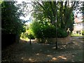
Westbourne: footpath A06 from Milner Road
Looking towards the start of this public footpath from the dead end of Milner Road. The path leads down to West Overcliff Drive, and is 48m in length.
See Image for the next photo along the path, with links to further pictures along the route.
Image: © Chris Downer
Taken: 14 Jul 2016
0.04 miles
2

Westbourne: footpath A06 heads for Milner Road
Looking along this fairly steep path from West Overcliff Drive as it ascends towards the dead end of Milner Road, thick with tall hedges or bushes on both sides.
See Image for a view towards us from the end of the path ahead, and Image for the view down the path behind us.
Image: © Chris Downer
Taken: 14 Jul 2016
0.05 miles
3
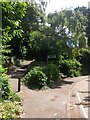
Westbourne: footpath A06 to Milner Road
The public footpath bears steeply off to the left, arriving at the dead end of Milner Road. The footpath is 48m in length.
See Image for the view towards us from a little way up the path, and links to further photos on the route.
Image: © Chris Downer
Taken: 14 Jul 2016
0.07 miles
4

Westbourne: under large branches on footpath A06
This short public footpath leads down to West Overcliff Drive, passing below two branches of a silver birch.
See Image for the next view along the path ahead, and Image for the next view behind us.
Image: © Chris Downer
Taken: 14 Jul 2016
0.07 miles
5
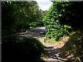
Westbourne: footpath A06 arrives on West Overcliff Drive
This 48m-long public footpath arrives at its destination from the dead end of Milner Road.
See Image for the view up the path from the bottom, and Image for the next view on the path behind us.
Image: © Chris Downer
Taken: 14 Jul 2016
0.07 miles
6
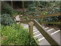
Middle Chine - West Overcliff Drive
Image: © Betty Longbottom
Taken: 21 Apr 2016
0.08 miles
7

Westbourne: steps down to Middle Chine
West Overcliff Drive crosses Middle Chine, and here we see the steep steps leading down the side of the chine from the road.
Image: © Chris Downer
Taken: 1 Jul 2012
0.09 miles
8

Westbourne: borough coat of arms on bridge
The Bournemouth Borough coat of arms is incorporated into the ironwork of this bridge, carrying West Overcliff Drive over Middle Chine. In the background are Image
Image: © Chris Downer
Taken: 1 Jul 2012
0.09 miles
9
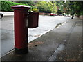
Bournemouth: postbox № BH4 120, McKinley Road
An Edward VII-reign postbox in a very desirable area.
Image: © Chris Downer
Taken: 4 Sep 2008
0.09 miles
10

Westbourne: Middle Chine passes under West Overcliff Drive
Looking up the chine through the arch of the bridge carrying West Overcliff Drive across. We are looking at it from a little way up some steps leading up to the road.
Image: © Chris Downer
Taken: 1 Jul 2012
0.10 miles