
IMAGES TAKEN NEAR TO
Wimborne Road, BOURNEMOUTH, BH2 6NB
Introduction
This page details the photographs taken nearby to Wimborne Road, BH2 6NB by members of the Geograph project.
The Geograph project started in 2005 with the aim of publishing, organising and preserving representative images for every square kilometre of Great Britain, Ireland and the Isle of Man.

There are currently over 7.5m images from over14,400 individuals and you can help contribute to the project by visiting https://www.geograph.org.uk
Image Map
Images are licensed for reuse under creativecommons.org/licenses/by-sa/2.0
Notes
- Clicking on the map will re-center to the selected point.
- The higher the marker number, the further away the image location is from the centre of the postcode.
Image Listing (70 Images Found)
Images are licensed for reuse under creativecommons.org/licenses/by-sa/2.0
Image
Details
Distance
1
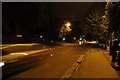
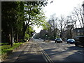
Bournemouth : Wimborne Road A347
Bournemouth was quite quiet during this night despite all the pesky students being back to university.
Image: © Lewis Clarke
Taken: 5 Oct 2010
0.02 miles
3
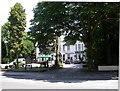
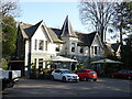
Bournemouth, The Dean Park Inn
Sheltered by trees at the corner of Wimborne and Landsdowne Roads. Internally, two separate rooms with front L-shaped bar; some high ceilings and wood panelling; pool and patio. Cask ales on offer at my visit: Wadworth 6X, Henry's, Horizon. For some customer comments, see http://www.beerintheevening.com/pubs/s/27/2783/Dean_Park_Inn/Bournemouth
Image: © Mike Faherty
Taken: 21 Jun 2010
0.04 miles
6
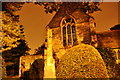
Bournemouth : St. Augustin Church
A church is lit up by the surrounding orange light of the street lights despite it being very dark.
Image: © Lewis Clarke
Taken: 5 Oct 2010
0.07 miles
7
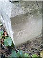
Ordnance Survey Cut Bench Mark
A rather chunky cut Ordnance Survey cut bench mark located on the base of St. Augustin's Church in Bournemouth. http://btcp.org.uk/who-we-are/st-augustins/
Image: © Mat Tuck
Taken: 10 Dec 2013
0.07 miles
8
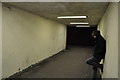
Bournemouth : Road Underpass
A subway under Lansdowne Road with one young man standing and keeping shelter from the rain.
Image: © Lewis Clarke
Taken: 5 Oct 2010
0.08 miles
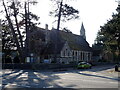
10
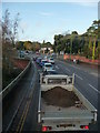
Bournemouth : Lansdowne Road
Waiting at the traffic lights at Lansdowne Road, and Cemetery Junction.
Image: © Lewis Clarke
Taken: 20 Nov 2009
0.08 miles