
IMAGES TAKEN NEAR TO
Durrant Road, BOURNEMOUTH, BH2 6LE
Introduction
This page details the photographs taken nearby to Durrant Road, BH2 6LE by members of the Geograph project.
The Geograph project started in 2005 with the aim of publishing, organising and preserving representative images for every square kilometre of Great Britain, Ireland and the Isle of Man.

There are currently over 7.5m images from over14,400 individuals and you can help contribute to the project by visiting https://www.geograph.org.uk
Image Map
Images are licensed for reuse under creativecommons.org/licenses/by-sa/2.0
Notes
- Clicking on the map will re-center to the selected point.
- The higher the marker number, the further away the image location is from the centre of the postcode.
Image Listing (649 Images Found)
Images are licensed for reuse under creativecommons.org/licenses/by-sa/2.0
Image
Details
Distance
1
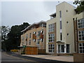
Bournemouth: 4 Durrant Road
A smart new development of flats round the back of the town centre.
Image: © Chris Downer
Taken: 4 Sep 2008
0.02 miles
2
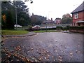
Bournemouth: the dead end of Durrant Road
Durrant Road was severed to allow the Wessex Way, town-centre by-pass, to be built, in the early 1970s. It is appreciable from here that the continuation of the road was past the house in the distance, although the road name changed, as it still does, to Central Drive at this point.
After the house on the right, a public footpath heads alongside the dual carriageway and on to Braidley Road below it; the path also links up with another to the end of Central Drive, so pedestrian access is available to the opposite side of the main road.
See Image for the view along the footpath, with links to further photos along the route.
Image: © Chris Downer
Taken: 4 Nov 2016
0.02 miles
3
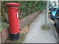
Bournemouth: postbox № BH2 13, Durrant Road
An Edward VII-reign postbox in what has been a quiet cul-de-sac since 1973 when the bypass was put in.
Image: © Chris Downer
Taken: 4 Sep 2008
0.02 miles
4
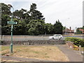
Durrant Road dead end
Road dead end which was severed by the building of the Wessex Way. Footpath to Braidley Road runs to the right.
Image: © Mat Tuck
Taken: 23 Jul 2013
0.02 miles
5
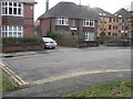
Bournemouth: The Samaritans
If you have reached this particular dead end in Durrant Road, the Samaritans are here to help. The dead end is caused by the town-centre by-pass, before which the road continued into Meyrick Park. Pedestrians can still get through to Meyrick Park by way of a footpath via Image
Image: © Chris Downer
Taken: 28 Dec 2007
0.02 miles
6
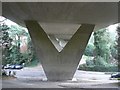
Bournemouth: under Braidley Road viaduct
Looking east underneath the town-centre by-pass, Baridley Road is at the bottom. See Image
Image: © Chris Downer
Taken: 28 Dec 2007
0.03 miles
7
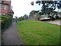
Bournemouth: footpath B11 to Durrant Road
Durrant Road and Central Drive were cut off from each other in 1973 by the building of the by-pass. This public footpath heads down from the former to Braidley Road, under the by-pass, and also provides access to the latter via another path.
Here, we look up towards the resulting dead end of Durrant Road.
See Image for the next view on the path ahead, and Image for the next view on the path behind us, with links to other photos along the route.
Image: © Chris Downer
Taken: 26 Feb 2010
0.04 miles
8
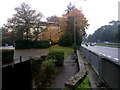
Bournemouth: footpath B11 reaches Durrant Road
Looking along the edge of the Wessex Way, town-centre by-pass, towards the dead end of Durrant Road - it is evident that Durrant Road was severed to allow the main road to be built, in the early 1970s.
The public footpath comes up from Braidley Road behind us, and also connects with another path to Central Drive, which was the continuation of Durrant Road before the by-pass was put through.
See Image for the view towards us from ahead, and Image for the next view on the path behind us, with links to further photos along the route.
Image: © Chris Downer
Taken: 4 Nov 2016
0.04 miles
9
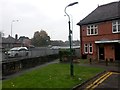
Bournemouth: footpath B11 from Durrant Road
Looking along a public footpath, alongside the town-centre by-pass, to Braidley Road from the dead end of Durrant Road - Durrant Road was severed to allow the main road to be built, in the early 1970s.
The public footpath also connects with another path to Central Drive, across the main road, which was the continuation of Durrant Road before the by-pass was put through.
The footpath is waymarked with a sign on the lamppost.
See Image for a more appreciable view of the road layout here, and Image for the view towards us from along the path ahead, with links to further photos along the route.
Image: © Chris Downer
Taken: 4 Nov 2016
0.04 miles
10
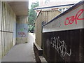
Footpath adjacent to the Wessex Way
Footpath leading to the Meyrick Park Trail and Central Drive. The area is notorious for vandalism to the structures.
Image: © Mat Tuck
Taken: 23 Jul 2013
0.04 miles