IMAGES TAKEN NEAR TO
Cambridge Road, BOURNEMOUTH, BH2 6AG
Introduction
This page details the photographs taken nearby to Cambridge Road, BH2 6AG by members of the Geograph project.
The Geograph project started in 2005 with the aim of publishing, organising and preserving representative images for every square kilometre of Great Britain, Ireland and the Isle of Man.

There are currently over 7.5m images from over14,400 individuals and you can help contribute to the project by visiting https://www.geograph.org.uk
Image Map
Images are licensed for reuse under creativecommons.org/licenses/by-sa/2.0
Notes
- Clicking on the map will re-center to the selected point.
- The higher the marker number, the further away the image location is from the centre of the postcode.
Image Listing (450 Images Found)
Images are licensed for reuse under creativecommons.org/licenses/by-sa/2.0
Image
Details
Distance
1
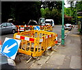
Yellow temporary barriers, Cambridge Road, Bournemouth
Enclosing holes in the road during roadworks at the northern end of Cambridge Road on May 25th 2016.
Image: © Jaggery
Taken: 25 May 2016
0.02 miles
2
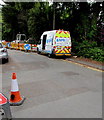
NPB van in Bournemouth
Parked at the northern end of Cambridge Road at the edge of roadworks on May 25th 2016. http://www.geograph.org.uk/photo/5015029
Based in Norway Business Centre in Yeovil, Somerset, NPB Utilities Ltd are specialists in the water industry.
Image: © Jaggery
Taken: 25 May 2016
0.02 miles
3
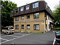
Bourneside Manor, Cambridge Road, Bournemouth
Flats at 11 Cambridge Road.
Image: © Jaggery
Taken: 25 May 2016
0.02 miles
4
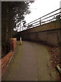
Bournemouth: path connecting Suffolk and Crescent Roads
This path joins these two roads at their dead-ends – before 1973 the two roads would have met, along with Surrey Road, at a point now occupied by the Image which we glimpse alongside us.
There are several such paths in Bournemouth – see for example Image
Image: © Chris Downer
Taken: 11 Feb 2010
0.02 miles
5
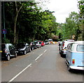
On-street parking, Cambridge Road, Bournemouth
The sign on the left shows that this northern end of Cambridge Road is not a through route for motor vehicles. The roadway ends ahead, at the edge of the A338 Wessex Way.
Image: © Jaggery
Taken: 25 May 2016
0.02 miles
6
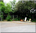
Fly tipping at the northern end of Cambridge Road, Bournemouth
Various items of junk have been dumped at the side of the road. Viewed on May 25th 2016.
Image: © Jaggery
Taken: 25 May 2016
0.03 miles
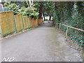
8
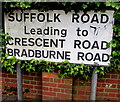
Conspicuous Suffolk Road name sign, Bournemouth
Located here. http://www.geograph.org.uk/photo/5014968
Image: © Jaggery
Taken: 25 May 2016
0.06 miles
9
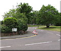
Bench on a Bournemouth corner
On the corner of Suffolk Road and Cambridge Road.
Image: © Jaggery
Taken: 25 May 2016
0.06 miles