
IMAGES TAKEN NEAR TO
Crescent Road, BOURNEMOUTH, BH2 5SS
Introduction
This page details the photographs taken nearby to Crescent Road, BH2 5SS by members of the Geograph project.
The Geograph project started in 2005 with the aim of publishing, organising and preserving representative images for every square kilometre of Great Britain, Ireland and the Isle of Man.

There are currently over 7.5m images from over14,400 individuals and you can help contribute to the project by visiting https://www.geograph.org.uk
Image Map
Images are licensed for reuse under creativecommons.org/licenses/by-sa/2.0
Notes
- Clicking on the map will re-center to the selected point.
- The higher the marker number, the further away the image location is from the centre of the postcode.
Image Listing (679 Images Found)
Images are licensed for reuse under creativecommons.org/licenses/by-sa/2.0
Image
Details
Distance
2
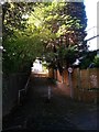
Bournemouth: footpath B19 from the Central Gardens
This public footpath is a short, fairly steep path linking Crescent Road with the Central Gardens. The No Cycling sign is significant because the connecting pathway, along the southwest edge of the Gardens, is designated as a shared foot/cycle route, with solid line down the middle to separate them.
See Image for the view down the path from Crescent Road.
Image: © Chris Downer
Taken: 26 Oct 2016
0.03 miles
4
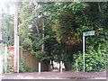
Bournemouth: footpath B19
A short - 29m according to one source - public footpath linking Crescent Road with the Central Gardens. It is a fair gradient, as shown by the fence panels on the left.
See Image for the view up from the other end.
Image: © Chris Downer
Taken: 13 Jun 2016
0.04 miles
5
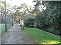
Bournemouth: Gardens Tennis Centre pavilion
The main building of the Image, which is also a café open to the public. It can be seen that the Bourne stream goes directly under the building.
Image: © Chris Downer
Taken: 27 Jan 2008
0.04 miles
6
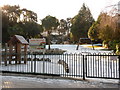
Bournemouth: Jurassic Play Jungle
It was not exactly clear to me just how this playpark differed from many other recreational areas with playthings. It occupies the banked site, on the south side of the Central Gardens, which until a couple of years ago contained a putting course.
Image: © Chris Downer
Taken: 7 Jan 2010
0.04 miles
7
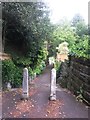
Bournemouth: footpath B18 from Bradburne Road
Two old fashioned concrete posts mark the start of the short public footpath down to an offshoot of the Central Gardens - see Image for a picture of the steps at the other end of the path.
Image: © Chris Downer
Taken: 13 Jun 2016
0.04 miles
8
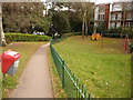
Bournemouth: small playpark in Crescent Road
This small park stands by the dead-end of Crescent Road, which has been thus since 1973 when the Image (just out of shot to the left) was built. Prior to that, Crescent, Cambridge and Surrey Roads met close to here.
The footpath ahead leads into the Central Gardens.
Image: © Chris Downer
Taken: 11 Feb 2010
0.04 miles
10
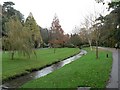
Bournemouth: Anne Frank?s tree, Central Gardens
The bare horse chestnut on the right was planted on 12 June 1988, and commemorates Anne Frank and all children who died in wars of the twentieth century – an appropriate subject on Remembrance Sunday morning while activities were centred on the Cenotaph a little further down the Gardens.
Image: © Chris Downer
Taken: 9 Nov 2008
0.05 miles