
IMAGES TAKEN NEAR TO
Durley Chine Road, BOURNEMOUTH, BH2 5JP
Introduction
This page details the photographs taken nearby to Durley Chine Road, BH2 5JP by members of the Geograph project.
The Geograph project started in 2005 with the aim of publishing, organising and preserving representative images for every square kilometre of Great Britain, Ireland and the Isle of Man.

There are currently over 7.5m images from over14,400 individuals and you can help contribute to the project by visiting https://www.geograph.org.uk
Image Map
Images are licensed for reuse under creativecommons.org/licenses/by-sa/2.0
Notes
- Clicking on the map will re-center to the selected point.
- The higher the marker number, the further away the image location is from the centre of the postcode.
Image Listing (218 Images Found)
Images are licensed for reuse under creativecommons.org/licenses/by-sa/2.0
Image
Details
Distance
3
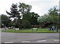
St Michael's Roundabout, Bournemouth
The 35 metre diameter roundabout is in the middle of the crossroads of Poole Road and the B3066.
In view are two combined ST MICHAELS ROUNDABOUT name signs and advertising signs.
Image: © Jaggery
Taken: 25 May 2016
0.03 miles
4
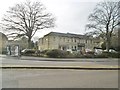
Bournemouth, medical centre
Poole Road Medical Centre, on Poole Road, with ancillary services: http://www.pooleroadmedicalcentre.co.uk/
Image: © Mike Faherty
Taken: 6 Jan 2018
0.03 miles
5
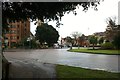
St Michael's roundabout
On Poole Road here looking toward Bournemouth centre. The tower of St Michael's church is just visible left of centre (Image). The Office building on the far left is called Midland Court.
Image: © David Lally
Taken: 16 Dec 2012
0.04 miles
6
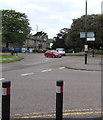
Southern end of Cambridge Road, Bournemouth
The B3066, here named Cambridge Road, approaches the Poole Road junction.
The CAMBRIDGE ROAD name sign is on the lamppost on the right.
St Michael's Roundabout is on the left.
Image: © Jaggery
Taken: 25 May 2016
0.05 miles
7
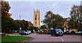
Roundabout near St. Michael's, Bournemouth
Image: © nick macneill
Taken: 18 Nov 2011
0.05 miles
8
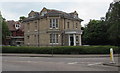
Ebenezer House, Poole Road, Bournemouth
In May 2016, Ebenezer House is the office of Stewart & Co LLP,
a four-partner firm of chartered and certified accountants.
Image: © Jaggery
Taken: 25 May 2016
0.05 miles
9
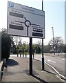
Bournemouth: 1063+272= lots of empty spaces
The first week of the Easter holidays would usually be very busy in Bournemouth, especially on such a gloriously sunny day.
However, due to the coronavirus pandemic of 2020, people are restricted to essential journeys only, i.e. shopping for essentials, medical, commuting if work cannot be done from home, and one period of exercise per day.
Therefore, holidaymakers will not be holiday-making, and locals will not be out in the numbers that they would usually be seen.
Therefore, there are vast numbers of parking spaces available in the town. This sign, facing the motorist arriving from either direction on the A338/A35, announces 1063 shoppers' parking spaces and 272 seafront spaces (although the sign may count spaces in car parks that have been closed to discourage outings).
There are even 98 bus/coach spaces available at the nearby coach park.
Image: © Chris Downer
Taken: 8 Apr 2020
0.06 miles
10
Marlborough Road - Durley Chine Road
Image: © Betty Longbottom
Taken: 19 Apr 2016
0.06 miles