IMAGES TAKEN NEAR TO
Hahnemann Road, BOURNEMOUTH, BH2 5EN
Introduction
This page details the photographs taken nearby to Hahnemann Road, BH2 5EN by members of the Geograph project.
The Geograph project started in 2005 with the aim of publishing, organising and preserving representative images for every square kilometre of Great Britain, Ireland and the Isle of Man.

There are currently over 7.5m images from over14,400 individuals and you can help contribute to the project by visiting https://www.geograph.org.uk
Image Map
Images are licensed for reuse under creativecommons.org/licenses/by-sa/2.0
Notes
- Clicking on the map will re-center to the selected point.
- The higher the marker number, the further away the image location is from the centre of the postcode.
Image Listing (427 Images Found)
Images are licensed for reuse under creativecommons.org/licenses/by-sa/2.0
Image
Details
Distance
1
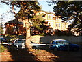
Bournemouth: Hahnemann House
A Victorian building standing on a plot in the middle of Hahnemann Road, which skirts round it like a large roundabout. Its postal address does not contain a number, just the street name – it would be difficult to decide between odd and even since it is on neither side!
Hahnemann House was originally a convalescent home, but is currently a branch of Dorset NHS Trust which provides services for those with mental health issues.
I can find no trace of the derivation of the name, but I suspect it has something to do with Samuel Hahnemann (1755-1843), who created homeopathy (or homœopathy as it would then have been written).
Image: © Chris Downer
Taken: 4 Jan 2010
0.02 miles
2
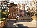
Bournemouth: Hahnemann Road and House
Looking west towards Image ahead of us, showing how Hahnemann Road skirts around both sides of it, rather like a roundabout.
Image: © Chris Downer
Taken: 4 Jan 2010
0.03 miles
4
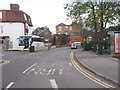
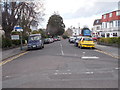
Hahnemann Road - Durley Road South
Image: © Betty Longbottom
Taken: 17 Apr 2016
0.04 miles
5
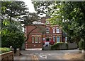
Bournemouth, Hahnemann House
Mental Health Unit on Hahnemann Road. http://www.nhs.uk/ServiceDirectories/Pages/Hospital.aspx?id=RDYCQ
Image: © Mike Faherty
Taken: 25 Jul 2010
0.04 miles
8
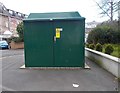
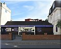
Electricity Substation - West Hill Road
Image: © Betty Longbottom
Taken: 17 Apr 2016
0.06 miles
9
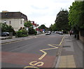
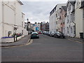
Durley Road, Bournemouth
Looking south along Durley Road towards Cecil Court Hotel and Durley Grange Hotel.
The yellow road markings are part of the Keep Clear zone outside St Michael's Primary School.
The zone ends near the Somerville Road junction.
Image: © Jaggery
Taken: 25 May 2016
0.06 miles