
IMAGES TAKEN NEAR TO
Linnet Close, RINGWOOD, BH24 3RE
Introduction
This page details the photographs taken nearby to Linnet Close, BH24 3RE by members of the Geograph project.
The Geograph project started in 2005 with the aim of publishing, organising and preserving representative images for every square kilometre of Great Britain, Ireland and the Isle of Man.

There are currently over 7.5m images from over14,400 individuals and you can help contribute to the project by visiting https://www.geograph.org.uk
Image Map
Images are licensed for reuse under creativecommons.org/licenses/by-sa/2.0
Notes
- Clicking on the map will re-center to the selected point.
- The higher the marker number, the further away the image location is from the centre of the postcode.
Image Listing (17 Images Found)
Images are licensed for reuse under creativecommons.org/licenses/by-sa/2.0
Image
Details
Distance
1
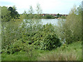
Hightown Lake
This lake was formed after gravel extraction had finished. The lake was used for water skiing, but now it is exclusively for fishing. Housing estates sprang up around the lake in the late eighties early nineties.
Image: © Stuart Buchan
Taken: 15 May 2005
0.09 miles
2
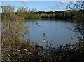
Hightown Lake
Another view of Image from Ringwood Bridleway 509. On the left across the water is an island. The housing at the far end is on Watership Drive.
Image: © Derek Harper
Taken: 12 Oct 2009
0.17 miles
3
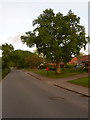
Hightown: postbox № BH24 72, Hightown Road
This small postbox, under a large oak tree, is emptied at 9 o'clock each weekday and Saturday morning.
Image: © Chris Downer
Taken: 18 May 2009
0.18 miles
4
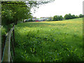
Mushroom Farm, Hightown, Ringwood
This mushroom farm is on the edge of a housing estate. It can be smelly on hot days. I know I live nearby.
Image: © Stuart Buchan
Taken: 15 May 2005
0.20 miles
5
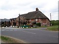
The Elm Tree, Hightown
A thatched country pub on the edge of the New Forest.
Image: © Maigheach-gheal
Taken: 18 May 2010
0.21 miles
6
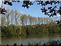
Hightown Lake
This view of Image is from Ringwood Bridleway 509.
Image: © Derek Harper
Taken: 12 Oct 2009
0.21 miles
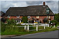
8
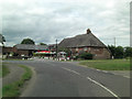
The Elm Tree
This is a Grade II listed, 18th C. public house with 20th C. extensions. It has English Heritage Building ID: 143704.
Image: © Stuart Logan
Taken: 16 Jul 2014
0.21 miles
9
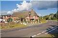
The Elm Tree pub, Hightown Road, Ringwood
The road to the right is Crow Lane.
Image: © Peter Facey
Taken: 26 Sep 2007
0.21 miles
10

Fields near Hightown Lake
The lake is behind the row of poplars. This view is from Ringwood Bridleway 509 as it follows the former railway line just east of Crow Lane.
Image: © Derek Harper
Taken: 12 Oct 2009
0.21 miles