IMAGES TAKEN NEAR TO
Larch Close, RINGWOOD, BH24 2PR
Introduction
This page details the photographs taken nearby to Larch Close, BH24 2PR by members of the Geograph project.
The Geograph project started in 2005 with the aim of publishing, organising and preserving representative images for every square kilometre of Great Britain, Ireland and the Isle of Man.

There are currently over 7.5m images from over14,400 individuals and you can help contribute to the project by visiting https://www.geograph.org.uk
Image Map
Images are licensed for reuse under creativecommons.org/licenses/by-sa/2.0
Notes
- Clicking on the map will re-center to the selected point.
- The higher the marker number, the further away the image location is from the centre of the postcode.
Image Listing (17 Images Found)
Images are licensed for reuse under creativecommons.org/licenses/by-sa/2.0
Image
Details
Distance
1
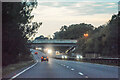
St Leonards and St Ives : The A31
Heading along the A31 through Dorset.
Image: © Lewis Clarke
Taken: 18 Oct 2020
0.06 miles
2
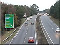
St. Ives: the new A31
This dual carriageway from Ferndown to Ringwood was built in the late 1960s, leaving the Image to act as a service road alongside.
The slip-roads visible in the distance, at the junction of the A338, were put in in the late 1980s, before which it was a one-level roundabout.
Image: © Chris Downer
Taken: 24 Nov 2007
0.09 miles
3
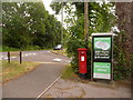
St. Ives: postbox № BH24 3 and phone, Ringwood Road
These two facilities stand outside Image The postbox receives its final collections at 3:45 on weekday afternoons and at 10 o'clock on Saturday mornings.
Image: © Chris Downer
Taken: 8 Jun 2009
0.09 miles
4
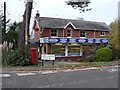
St. Ives: post office
Situated on the corner of the old main road and Post Office Lane.
The width of the A-road symbol on the 1:50,000 map, along with its representation of the old road alongside, means that the office appears to have been pushed into the next gridsquare north. However, a look at the 1:25,000 map will show that it is comfortably in this square.
Image: © Chris Downer
Taken: 24 Nov 2007
0.09 miles
5
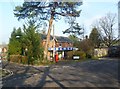
St. Ives Post Office & Stores
At the corner of Ringwood Road Service Road (old A31) and Post Office Lane.
Image: © Mike Faherty
Taken: 31 Jan 2012
0.09 miles
7
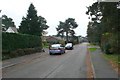
St Ives End Lane, Ashley Heath
St Ives End Lane runs from Sandy Lane south to the A31 the Ringwood Rd. This is the view S from close to the NW corner of the square.
Image: © Nigel Mykura
Taken: 26 Nov 2008
0.14 miles
9
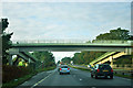
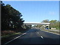
Footbridge over A31
This connects a residential area to the right to a country park.
Image: © Robin Webster
Taken: 30 Oct 2012
0.14 miles