IMAGES TAKEN NEAR TO
CHRISTCHURCH, BH23 9JP

Introduction

This page details the photographs taken nearby to BH23 9JP by members of the Geograph project.

The Geograph project started in 2005 with the aim of publishing, organising and preserving representative images for every square kilometre of Great Britain, Ireland and the Isle of Man.

There are currently over 7.5m images from over14,400 individuals and you can help contribute to the project by visiting https://www.geograph.org.uk

Image Map


Images are licensed for reuse under creativecommons.org/licenses/by-sa/2.0
Notes
  • Clicking on the map will re-center to the selected point.
  • The higher the marker number, the further away the image location is from the centre of the postcode.

Image Listing (220 Images Found)

Images are licensed for reuse under creativecommons.org/licenses/by-sa/2.0
  • ...
Image
Details
Distance
1
Christchurch: the new Delivery Office, Reid Street
The Royal Mail Delivery Office was formerly in Wick Lane in the town centre, alongside what was also the main post office until the late 1990s. The post office has moved a couple of times since then, still in the town centre, but the Delivery Office remained there until early 2018 when it moved to these premises on a small industrial estate in the suburbs.
Image: © Chris Downer Taken: 24 Nov 2018
0.01 miles
2
Christchurch Delivery Office
Recently relocated from the town centre to new premises on Image
Image: © Mike Faherty Taken: 6 Aug 2010
0.01 miles
3
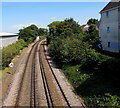
Railway NE of Christchurch station
Viewed from Fairmile Road bridge. The trackside sign shows a 70mph speed limit.
Image: © Jaggery Taken: 24 Aug 2016
0.03 miles
4
WWII defences in the environs of Bournemouth & Christchurch: Avon Trading Park, Christchurch - cubes (4)
- Anti-tank Blocks: DoB ID: S0013852 A line of 31 anti-tank blocks parallel with the railway and W of the River Avon extends westwards past the Royal Mail building beyond. The cubes vary in height from 5 - 7 feet with a constant spacing between them of around 3 feet. Image
Image: © Mike Searle Taken: 6 Mar 2016
0.04 miles
5
WWII defences in the environs of Bournemouth & Christchurch: Avon Trading Park, Christchurch - cubes (5)
- Anti-tank Blocks: DoB ID: S0013852 A view in the opposite direction of the line of anti-tank blocks with the pillbox between them seen at the far end. The line continues beyond the fence behind the pillbox, and into the adjacent yard. Image
Image: © Mike Searle Taken: 6 Mar 2016
0.04 miles
6
WWII defences in the environs of Bournemouth & Christchurch: Avon Trading Park, Christchurch - cubes (6)
- Anti-tank Blocks: DoB ID: S0013852 A close-up of one of the concrete blocks showing the steel reinforcing that has been exposed by the spalling of the concrete. Image
Image: © Mike Searle Taken: 6 Mar 2016
0.04 miles
7
Ordnance Survey Cut Mark
This can be found on the wall of the Railway Bridge in Fairmile Road. For more detail see : http://www.bench-marks.org.uk/bm35948
Image: © Peter Wood Taken: 4 Jun 2016
0.04 miles
8
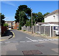
Lights Close, Christchurch
Cul-de-sac on the west bank of the River Avon, viewed across Fairfield.
Image: © Jaggery Taken: 24 Aug 2016
0.05 miles
9
Bridge, Christchurch
The bridge takes the B3073 over the railway line. There is an Ordnance Survey bench mark on the brick pillar.
Image: © Maigheach-gheal Taken: 9 Nov 2010
0.05 miles
10
Fairmile Road Bridge carrying traffic over the railway line
Looking north-westward.
Image: © Peter Wood Taken: 4 Jun 2016
0.05 miles
  • ...