
IMAGES TAKEN NEAR TO
Shirley Close, CHRISTCHURCH, BH23 8NU
Introduction
This page details the photographs taken nearby to Shirley Close, BH23 8NU by members of the Geograph project.
The Geograph project started in 2005 with the aim of publishing, organising and preserving representative images for every square kilometre of Great Britain, Ireland and the Isle of Man.

There are currently over 7.5m images from over14,400 individuals and you can help contribute to the project by visiting https://www.geograph.org.uk
Image Map
Images are licensed for reuse under creativecommons.org/licenses/by-sa/2.0
Notes
- Clicking on the map will re-center to the selected point.
- The higher the marker number, the further away the image location is from the centre of the postcode.
Image Listing (47 Images Found)
Images are licensed for reuse under creativecommons.org/licenses/by-sa/2.0
Image
Details
Distance
1
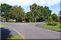
Rosehill Drive, Bransgore
The road divides here, but both arms are named Rosehill Drive.
Image: © mike smith
Taken: 17 Jul 2012
0.03 miles
2
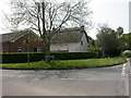
Bransgore, The Willows
Thatched cottage at the junction of Burnt House & Betsy Lanes; surprising that local planners allowed the neighbouring bungalow.
Image: © Mike Faherty
Taken: 11 May 2009
0.04 miles
3
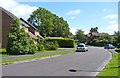
Rosehill Drive, Bransgore
This is a very pleasant residential area, within walking distance of the local shops.
Image: © mike smith
Taken: 17 Jul 2012
0.05 miles
4
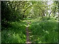
Bransgore, footpath
Footpath along the Southern edge of Image; the trees also form a screen between houses in Rosehill Drive, to the left, and the green.
Image: © Mike Faherty
Taken: 11 May 2009
0.06 miles
5
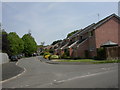
Bransgore, Tyrells Court
Modern housing, a stone's throw away from thatched cottages and open fields.
Image: © Mike Faherty
Taken: 11 May 2009
0.08 miles
6
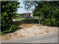
Bransgore, gas installation
On Burnt House Lane; industrial-looking for a semi-rural position. According to planning application at the entrance, a gas pressure reducing station.
Image: © Mike Faherty
Taken: 11 May 2009
0.09 miles
7
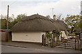
The Thatched Cottage, Betsy Lane, Bransgore
A low building aboujt 24 metres long.
Image: © Peter Facey
Taken: 12 May 2010
0.12 miles
8
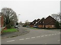
Rosehill Drive, Bransgore
Rosehill Drive is a residential cul-de-sac in the village of Bransgore in Hampshire.
This image was taken on a dull day in late December. Deciduous trees were bare for the winter season.
Image: © Malc McDonald
Taken: 28 Dec 2024
0.12 miles
9
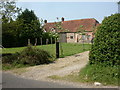
Bransgore, Burnt House Farmhouse
On Burnt House Lane; looks very spick and span, so it might have been converted.
Image: © Mike Faherty
Taken: 11 May 2009
0.12 miles
10
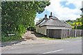
Stouts Lane, Bransgore
This unmade lane is also designated as a footpath - see the finger post to the left of the lane entrance. The thatched cottage is one of several in Bransgore, showing that the village was well established some two or three centuries ago.
Image: © mike smith
Taken: 17 Jul 2012
0.12 miles