IMAGES TAKEN NEAR TO
Avon Tyrrell, Bransgore, CHRISTCHURCH, BH23 8EE

Introduction

This page details the photographs taken nearby to BH23 8EE by members of the Geograph project.

The Geograph project started in 2005 with the aim of publishing, organising and preserving representative images for every square kilometre of Great Britain, Ireland and the Isle of Man.

There are currently over 7.5m images from over14,400 individuals and you can help contribute to the project by visiting https://www.geograph.org.uk

Image Map


Images are licensed for reuse under creativecommons.org/licenses/by-sa/2.0
Notes
  • Clicking on the map will re-center to the selected point.
  • The higher the marker number, the further away the image location is from the centre of the postcode.

Image Listing (16 Images Found)

Images are licensed for reuse under creativecommons.org/licenses/by-sa/2.0
Image
Details
Distance
1
Avon Tyrrell, Avon Clump
Mature pine trees between the activity centre and open forest. http://www.avontyrrell.org.uk/page/Welcome.jsf
Image: © Mike Faherty Taken: 12 Dec 2011
0.03 miles
2
Avon Tyrrell, stile
At the boundary of open forest and the activity centre, behind Avon Clump. http://www.avontyrrell.org.uk/page/Welcome.jsf
Image: © Mike Faherty Taken: 12 Dec 2011
0.07 miles
3
Avon Tyrrell, lodges
Accommodation at the activity centre. http://www.avontyrrell.org.uk/page/accommodation.jsf
Image: © Mike Faherty Taken: 12 Dec 2011
0.09 miles
4
Avon Tyrrell, bike tracks
Graded tracks at the activity centre. http://www.avontyrrell.org.uk/page/cyclinginthenewforest.jsf?cid=1714
Image: © Mike Faherty Taken: 12 Dec 2011
0.09 miles
5
Avon Tyrrell - Stable Block
Grade II listed stable block in 'Arts and Crafts' style by W R Lethaby in 1892 for Lord Manners.
Image: © John M Taken: 17 Jun 2018
0.13 miles
6
Avon Tyrrell, driveway
From the activity centre, across horse grazing to Braggers Lane. http://www.avontyrrell.org.uk/page/Welcome.jsf
Image: © Mike Faherty Taken: 12 Dec 2011
0.13 miles
7
Avon Tyrrell, New Forest
Avon Tyrrell provides fun educational and activity holidays for people of all ages and abilities. The photograph is of the access road to the centre.
Image: © Stuart Buchan Taken: 7 Aug 2005
0.14 miles
8
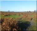
Lugden Bottom, heathland
Near the western boundary of the open forest; as its name suggests, wet and boggy.
Image: © Mike Faherty Taken: 12 Dec 2011
0.17 miles
9
Whitefield Hill, fence
Marking the boundary between open forest land, right, and Bisterne Common, left.
Image: © Mike Faherty Taken: 12 Dec 2011
0.17 miles
10
Track up Whitefield Hill, New Forest
This track climbs Whitefield Hill up to Avon Clump on the hilltop. The southern part of Dur Hill inclosure is on the left and the south-eastern edge of Bisterne Common is on the right.
Image: © Jim Champion Taken: 21 Jul 2007
0.19 miles