IMAGES TAKEN NEAR TO
Vicarage Way, CHRISTCHURCH, BH23 7NE
Introduction
This page details the photographs taken nearby to Vicarage Way, BH23 7NE by members of the Geograph project.
The Geograph project started in 2005 with the aim of publishing, organising and preserving representative images for every square kilometre of Great Britain, Ireland and the Isle of Man.

There are currently over 7.5m images from over14,400 individuals and you can help contribute to the project by visiting https://www.geograph.org.uk
Image Map (Loading...)


Getting Data...Please wait
Leaflet Map data © OpenStreetMap
Images are licensed for reuse under creativecommons.org/licenses/by-sa/2.0
Notes
- Clicking on the map will re-center to the selected point.
- The higher the marker number, the further away the image location is from the centre of the postcode.
Image Listing (56 Images Found)
Images are licensed for reuse under creativecommons.org/licenses/by-sa/2.0
Image
Details
Distance
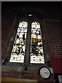
6
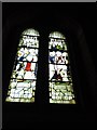
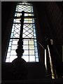
St Luke, Burton Green: south facing window
Image: © Basher Eyre
Taken: 15 Jun 2012
0.03 miles
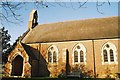
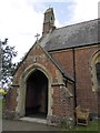
10
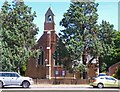
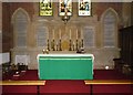
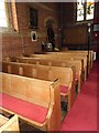
St Luke's Parish Church, Burton
This is the local Church of England church. The building dates from 1874.
Image: © mike smith
Taken: 6 Jul 2010
0.04 miles