
IMAGES TAKEN NEAR TO
Bockhampton Road, CHRISTCHURCH, BH23 7AE
Introduction
This page details the photographs taken nearby to Bockhampton Road, BH23 7AE by members of the Geograph project.
The Geograph project started in 2005 with the aim of publishing, organising and preserving representative images for every square kilometre of Great Britain, Ireland and the Isle of Man.

There are currently over 7.5m images from over14,400 individuals and you can help contribute to the project by visiting https://www.geograph.org.uk
Image Map
Images are licensed for reuse under creativecommons.org/licenses/by-sa/2.0
Notes
- Clicking on the map will re-center to the selected point.
- The higher the marker number, the further away the image location is from the centre of the postcode.
Image Listing (20 Images Found)
Images are licensed for reuse under creativecommons.org/licenses/by-sa/2.0
Image
Details
Distance
1
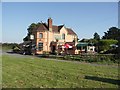
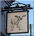
The Lamb Inn
Just outside the village of Winkton, this is a popular pub/restaurant with people from the general area. It changed ownership recently, and has been repainted in a daring shade of pink!
Image: © mike smith
Taken: 25 Aug 2007
0.00 miles
2
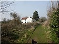
Winkton, Holfleet Cottage
Cottage on the outskirts of Winkton village, on the Avon Valley Path http://www3.hants.gov.uk/longdistance/avon-valley-path/sopley-christchurch.htm
Image: © Mike Faherty
Taken: 21 Mar 2009
0.02 miles
3
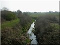
Winkton, stream
Apparently nameless stream which rises in Bransgore and flows into the Avon near Burton. Seen looking downstream from roadbridge on Burley Road, on the Avon Valley Path http://www3.hants.gov.uk/longdistance/avon-valley-path/sopley-christchurch.htm
Image: © Mike Faherty
Taken: 21 Mar 2009
0.03 miles
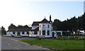
6
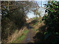
The Avon Valley Path approaching Winkton
Image: © Tim Heaton
Taken: 26 Jan 2012
0.04 miles
7
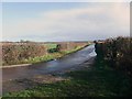
Bockhampton Road
Looking up the route I will take to Lyndhurst, at the point where I leave the Avon Valley Path
Image: © Tim Heaton
Taken: 26 Jan 2012
0.05 miles
9
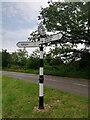
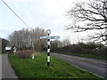
Direction Sign - Signpost on Burley Road, Winkton
Located in Winkton on the north side of the Y junction of Burley Road and Harpway Lane, Burton and Winkton parish. 3 arms, 1 missing, and annulus finial. See also https://www.geograph.org.uk/photo/6096019. In 2013 it was the Winkton and Burton arm that was missing, now the Bransgore and Burley arm is missing, though the fingerpost has been refurbished.
Milestone Society National ID: HA_SZ1696
Image: © P Blake
Taken: 2 Jun 2021
0.09 miles
10
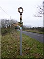
Direction Sign - Signpost on Burley Road, Winkton
Annulus finial - 3 arms, 1 missing; Hants halo by the UC road, in parish of Burton and Winkton (Christchurch District), in Winkton on the north side of the Y junction of Burley Road and Harpway Lane.
Surveyed
Milestone Society National ID: HA_SZ1696
Image: © M Faherty
Taken: 8 Jan 2013
0.09 miles