
IMAGES TAKEN NEAR TO
Hurn, CHRISTCHURCH, BH23 6AT
Introduction
This page details the photographs taken nearby to BH23 6AT by members of the Geograph project.
The Geograph project started in 2005 with the aim of publishing, organising and preserving representative images for every square kilometre of Great Britain, Ireland and the Isle of Man.

There are currently over 7.5m images from over14,400 individuals and you can help contribute to the project by visiting https://www.geograph.org.uk
Image Map
Images are licensed for reuse under creativecommons.org/licenses/by-sa/2.0
Notes
- Clicking on the map will re-center to the selected point.
- The higher the marker number, the further away the image location is from the centre of the postcode.
Image Listing (24 Images Found)
Images are licensed for reuse under creativecommons.org/licenses/by-sa/2.0
Image
Details
Distance
1
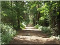
Footpath Along Former Railway Track
The former railway line between Ringwood and Christchurch (closed 1935) is now a footpath for some of its length. To the north of Hurn, much of the track has been covered by the A338 Bournemouth Link Road. To the south it is covered by housing and industrial developments.
Image: © mike smith
Taken: 16 Jun 2007
0.06 miles
2
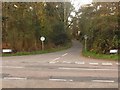
Hurn: Pithouse or Pitthouse Lane
The name is spelt with either one or two Ts, depending on which sign you refer to.
Image: © Chris Downer
Taken: 29 Mar 2009
0.07 miles
3
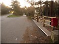
Hurn: postbox № BH23 98, Avon Causeway
This postbox is emptied daily except Sunday at 9am.
Beyond, we see the original route of the road (right), and the rerouted course over the bridge, since the A338 was but through in the mid-1960s.
Image: © Chris Downer
Taken: 29 Mar 2009
0.07 miles
4
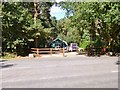
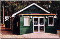
Hurn Chapel
On Avon Causeway; now the home of Space Industries Ltd. http://www.spaceindustries.co.uk/contact/index.php
Image: © Mike Faherty
Taken: 13 Sep 2012
0.08 miles
5
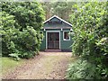
Hurn Gospel Mission Chapel
This wooden chapel is set back from the Avon Causeway, partly hidden in woodland. The Internet does not reveal any information about it.
Image: © mike smith
Taken: 16 Jun 2007
0.08 miles
7
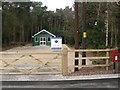
Hurn: the chapel
Hurn Chapel lies somewhat east of the village centre, close to the Avon Causeway Hotel which used to be the railway station. The surroundings have been cleared since June 2007, when the following picture was taken: Image
Image: © Chris Downer
Taken: 2 Mar 2008
0.09 miles
8
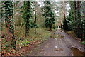
Track near Sopley Common
This long level dirt track runs along the line of a dismantled railway line
Image: © Nigel Mykura
Taken: 6 Mar 2019
0.10 miles
9
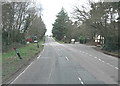
Avon Causeway crosses A338
It's quite a relief to find that the busy A338 is crossed by a bridge.
Image: © Stuart Logan
Taken: 18 Mar 2012
0.12 miles
10
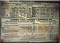
1881 railway timetable
The Avon Causeway was once upon a time Hurn station – the platform and a Pullman carriage are still there. Displayed on the platform this reproduction of a railway timetable dated (in modern lettering) 1881.
Image: © Chris Downer
Taken: Unknown
0.13 miles