
IMAGES TAKEN NEAR TO
Greywell, CHRISTCHURCH, BH23 6AJ
Introduction
This page details the photographs taken nearby to Greywell, BH23 6AJ by members of the Geograph project.
The Geograph project started in 2005 with the aim of publishing, organising and preserving representative images for every square kilometre of Great Britain, Ireland and the Isle of Man.

There are currently over 7.5m images from over14,400 individuals and you can help contribute to the project by visiting https://www.geograph.org.uk
Image Map
Images are licensed for reuse under creativecommons.org/licenses/by-sa/2.0
Notes
- Clicking on the map will re-center to the selected point.
- The higher the marker number, the further away the image location is from the centre of the postcode.
Image Listing (32 Images Found)
Images are licensed for reuse under creativecommons.org/licenses/by-sa/2.0
Image
Details
Distance
1
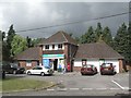
Hurn Stores
This shop and post office is the only general retail outlet in Hurn village.
Image: © mike smith
Taken: 16 Jun 2007
0.02 miles
2
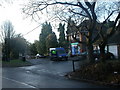
Hurn Post Office
Village store & post office in a scattered village that Bournemouth Airport was once named after.
Image: © Mike Faherty
Taken: 3 Dec 2008
0.03 miles
3
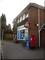
Hurn: post office and postbox № BH23 13
The excellent post office and village stores at Hurn, with George VI-reign postbox which is emptied at 5:15pm on weekdays and at noon on Saturdays.
Image: © Chris Downer
Taken: 29 Mar 2009
0.04 miles
4
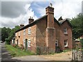
Old Cottages at Hurn
These two semi-detached cottages, dating from the mid 19th century, are now very comfortable modern homes.
Image: © mike smith
Taken: 16 Jun 2007
0.05 miles
5
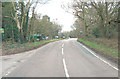
Avon Causeway enters Hurn Village
For a name that's synonymous with an airport its interesting to find out that Hurn is also a village.
Image: © Stuart Logan
Taken: 18 Mar 2012
0.05 miles
6
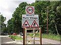
Welcome Signs
These new Welcome signs were erected on the four routes into Hurn Village in May 2007.
Image: © mike smith
Taken: 16 Jun 2007
0.08 miles
7
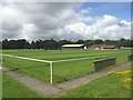
Hurn Bridge Sports Club
This modern sports facility is home for local cricket and football clubs, as well as several other sports.
Image: © mike smith
Taken: 16 Jun 2007
0.08 miles
8
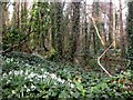
Hurn, snowdrops
A few of the thousands of snowdrops in woodland alongside Moors River, just North of Hurn Bridge, close to Image The river can be seen to the right.
Image: © Mike Faherty
Taken: 28 Feb 2009
0.09 miles
9
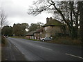
Home farmhouse, Hurn
Early C19 farmhouse, listed by English Heritage, on the B3073 just south of Hurn Bridge. http://www.imagesofengland.org.uk/Details/Default.aspx?id=101472&mode=adv
Image: © Mike Faherty
Taken: 27 Nov 2008
0.09 miles
10
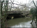
Hurn Bridge
Hurn Bridge was first mentioned in 1274, though this version looks a lot more modern. Taking traffic on the busy B3073 from Bournemouth/Christchurch to Bournemouth Airport & Wimborne, the bridge is brick built, and appears to be C19, with an extension to its north face for pedestrians. The bridge crosses Moors River, known further north as the Crane. http://www.dorsetlife.co.uk/articles/ArticlesDetail.asp?ID=565
Image: © Mike Faherty
Taken: 27 Nov 2008
0.09 miles