
IMAGES TAKEN NEAR TO
Hurn, CHRISTCHURCH, BH23 6AD
Introduction
This page details the photographs taken nearby to BH23 6AD by members of the Geograph project.
The Geograph project started in 2005 with the aim of publishing, organising and preserving representative images for every square kilometre of Great Britain, Ireland and the Isle of Man.

There are currently over 7.5m images from over14,400 individuals and you can help contribute to the project by visiting https://www.geograph.org.uk
Image Map
Images are licensed for reuse under creativecommons.org/licenses/by-sa/2.0
Notes
- Clicking on the map will re-center to the selected point.
- The higher the marker number, the further away the image location is from the centre of the postcode.
Image Listing (28 Images Found)
Images are licensed for reuse under creativecommons.org/licenses/by-sa/2.0
Image
Details
Distance
1
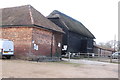
Old Farm Buildings
These buildings are at Hurnbridge Farm just south of Hurn close to the old bridge across the Moors River.
Image: © Nigel Mykura
Taken: 7 Feb 2019
0.02 miles
2
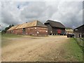
Hurn Bridge Farm
These old farm buildings are now part of an equestrian centre, although some farming activities appear to continue.
Image: © mike smith
Taken: 16 Jun 2007
0.02 miles
3
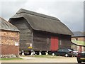
Old Barn at Hurn Bridge Farm
This barn is elevated on Staddle Stones. These mushroom-shaped stones were used to lift barns and granaries off the ground. This kept the contents dry, and stopped vermin getting in, as they were unable to climb past the staddle stone caps.
Image: © mike smith
Taken: 16 Jun 2007
0.03 miles
4
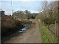
Hurn, Pussex Lane
Lane with an apparently unique name, leading from Hurn Bridge to Bournemouth Airport. To the left, outbuildings of Hurn Bridge Farm Image
Image: © Mike Faherty
Taken: 28 Feb 2009
0.04 miles
5
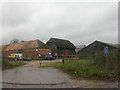
Hurn Bridge equestrian centre
Opened 1984, primarily as livery stables; previously Hurn Bridge Farm. Note the two very different styles of barn: to the left, with brick walls & buttresses; in the centre, weather-boarded, standing on staddle stones.
http://www.hurnbridgeec.co.uk/
Image: © Mike Faherty
Taken: 27 Nov 2008
0.05 miles
6
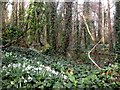
Hurn, snowdrops
A few of the thousands of snowdrops in woodland alongside Moors River, just North of Hurn Bridge, close to Image The river can be seen to the right.
Image: © Mike Faherty
Taken: 28 Feb 2009
0.09 miles
7
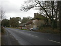
Home farmhouse, Hurn
Early C19 farmhouse, listed by English Heritage, on the B3073 just south of Hurn Bridge. http://www.imagesofengland.org.uk/Details/Default.aspx?id=101472&mode=adv
Image: © Mike Faherty
Taken: 27 Nov 2008
0.09 miles
8
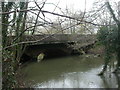
Hurn Bridge
Hurn Bridge was first mentioned in 1274, though this version looks a lot more modern. Taking traffic on the busy B3073 from Bournemouth/Christchurch to Bournemouth Airport & Wimborne, the bridge is brick built, and appears to be C19, with an extension to its north face for pedestrians. The bridge crosses Moors River, known further north as the Crane. http://www.dorsetlife.co.uk/articles/ArticlesDetail.asp?ID=565
Image: © Mike Faherty
Taken: 27 Nov 2008
0.09 miles
10
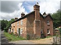
Old Cottages at Hurn
These two semi-detached cottages, dating from the mid 19th century, are now very comfortable modern homes.
Image: © mike smith
Taken: 16 Jun 2007
0.11 miles