IMAGES TAKEN NEAR TO
Braemar Drive, CHRISTCHURCH, BH23 5NP
Introduction
This page details the photographs taken nearby to Braemar Drive, BH23 5NP by members of the Geograph project.
The Geograph project started in 2005 with the aim of publishing, organising and preserving representative images for every square kilometre of Great Britain, Ireland and the Isle of Man.

There are currently over 7.5m images from over14,400 individuals and you can help contribute to the project by visiting https://www.geograph.org.uk
Image Map
Images are licensed for reuse under creativecommons.org/licenses/by-sa/2.0
Notes
- Clicking on the map will re-center to the selected point.
- The higher the marker number, the further away the image location is from the centre of the postcode.
Image Listing (27 Images Found)
Images are licensed for reuse under creativecommons.org/licenses/by-sa/2.0
Image
Details
Distance
2
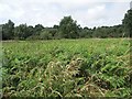
Chewton Common
This public-access area seems to have become completely overgrown with bracken, which extends right over to the trees.
Image: © mike smith
Taken: 17 Jul 2007
0.10 miles
4
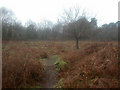
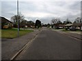
Chewton Common
Chewton Common comprises four parcels of land, separated by housing and roads.
This view is in the largest section, to the north of Chewton Common Road. Bracken, light deciduous tree cover; as seen on a wet January day.
Image: © Mike Faherty
Taken: 16 Jan 2009
0.18 miles
5
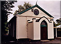
Cranemoor United Reformed Church
Grade 2 listed building erected in 1834.
Image: © Michael FORD
Taken: Unknown
0.19 miles
6
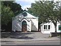
Walkford United Reformed Church
The near-by notice says that this church was established in 1829. There is a hall behind where several different groups hold their meetings.
Image: © mike smith
Taken: 17 Jul 2007
0.19 miles
7
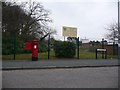
Highcliffe: postbox № BH23 76, Greenways
This Elizabeth II-reign postbox stands at the northern end of Greenways, opposite Denham Drive. It is emptied finally at 5:30pm on weekdays and at 12:15pm on Saturdays.
Behind, we see the grounds of Highcliffe St. Mark Primary, a fairly recent amalgamation of the former St. Mark's Infant and Highcliffe Junior Schools, on the original site of the latter.
Image: © Chris Downer
Taken: 31 Jan 2009
0.19 miles
8
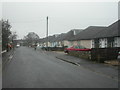
Walkford, bungalows
Bungalows in Southwood Avenue, which ends in Chewton Common Image Although structurally very similar, residents have differentiated them with paintwork and decorative features. Note the postman doing his rounds.
Image: © Mike Faherty
Taken: 16 Jan 2009
0.20 miles
9
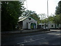
Walkford URC
On Ringwood Road, "Serving God and the Community since 1829". According to its web listing, now "Walkford Community Church", not reflected in its signage. http://christchurchgroupurc.org.uk/about/walkford/
Image: © Mike Faherty
Taken: 20 Sep 2010
0.20 miles