
IMAGES TAKEN NEAR TO
Radar Way, CHRISTCHURCH, BH23 4FL
Introduction
This page details the photographs taken nearby to Radar Way, BH23 4FL by members of the Geograph project.
The Geograph project started in 2005 with the aim of publishing, organising and preserving representative images for every square kilometre of Great Britain, Ireland and the Isle of Man.

There are currently over 7.5m images from over14,400 individuals and you can help contribute to the project by visiting https://www.geograph.org.uk
Image Map
Images are licensed for reuse under creativecommons.org/licenses/by-sa/2.0
Notes
- Clicking on the map will re-center to the selected point.
- The higher the marker number, the further away the image location is from the centre of the postcode.
Image Listing (23 Images Found)
Images are licensed for reuse under creativecommons.org/licenses/by-sa/2.0
Image
Details
Distance
1
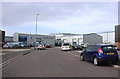
Airspeed Road
This is the priory Industrial Estate and the names of its roads are all to do with aircraft. Airspeed road is off Runway Rd and is next to Brabazon Rd.
Image: © Nigel Mykura
Taken: 6 Mar 2019
0.09 miles
2
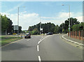
A337 roundabout
Taken from the Highcliffe Road with Hoburne Road to the right and The Runway to the left. That name gives the clue to the absence of the old Christchurch Airfield which was situated astride the road. It was a civil airfield starting from 1926 and was used during World War II by the RAF and the USAF - 9th Air Force. After the war the airfield returned to civilian use but was closed in the mid-sixties, most buildings were demolished in 1966. See also: http://en.wikipedia.org/wiki/Christchurch_Airfield
Image: © Stuart Logan
Taken: 7 Aug 2013
0.11 miles
3
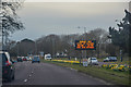
Christchurch : Highcliffe Road A337
A road heading into Christchurch.
Image: © Lewis Clarke
Taken: 26 Mar 2018
0.14 miles
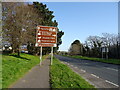
5
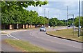
"The Runway"
This connecting road, and the houses around are built on the former Christchurch Airfield. Most of the roads off are named after types of aircraft, but this road is simply The Runway.
Image: © mike smith
Taken: 3 Jul 2010
0.15 miles
6
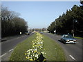
Highcliffe Road, Christchurch
The A337 Highcliffe Road alongside BAE Systems (formerly SRDE, Plesseys and British Aerospace).
Image: © Peter Beaven
Taken: 14 Mar 2007
0.15 miles
7
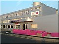
Spectrum Housing Group
The new reception entrance completed in February 2012.
Image: © Peter Beaven
Taken: 1 Mar 2012
0.16 miles
8
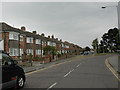
Grange Road, Christchurch
More housing on the former Christchurch airfield site.
Image: © Peter Beaven
Taken: 26 Apr 2007
0.17 miles
10
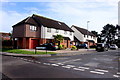
Houses in Saffron Drive
This is a short cul-de-sac section of Saffron Drive that backs on to the A337 Highcliffe Rd where the trees are.
Image: © Nigel Mykura
Taken: 6 Mar 2019
0.18 miles