
IMAGES TAKEN NEAR TO
Minterne Road, CHRISTCHURCH, BH23 3LE
Introduction
This page details the photographs taken nearby to Minterne Road, BH23 3LE by members of the Geograph project.
The Geograph project started in 2005 with the aim of publishing, organising and preserving representative images for every square kilometre of Great Britain, Ireland and the Isle of Man.

There are currently over 7.5m images from over14,400 individuals and you can help contribute to the project by visiting https://www.geograph.org.uk
Image Map
Images are licensed for reuse under creativecommons.org/licenses/by-sa/2.0
Notes
- Clicking on the map will re-center to the selected point.
- The higher the marker number, the further away the image location is from the centre of the postcode.
Image Listing (47 Images Found)
Images are licensed for reuse under creativecommons.org/licenses/by-sa/2.0
Image
Details
Distance
2
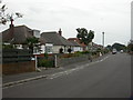
Stanpit, bungalows
Bungalows with different finishes in Minterne Road. The road was named after villages in West Dorset.
Image: © Mike Faherty
Taken: 24 Aug 2009
0.07 miles
3
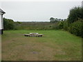
Stanpit, Tutton's Well
Ancient source of pure water for local inhabitants, reputed to have medicinal properties; donated to Christchurch in 1885, restored 2004. http://www.tuttons-well.org.uk/index.html Stanpit Marsh visible behind.
Image: © Mike Faherty
Taken: 24 Aug 2009
0.08 miles
4
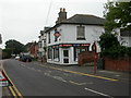
Stanpit, estate agents
On Stanpit. With green fascia, Barons, letting agents, http://www.baronsletting.co.uk/ with red/blue fascia, Finns, estate agents, http://www.finnsestates.co.uk/
Image: © Mike Faherty
Taken: 24 Aug 2009
0.08 miles

7
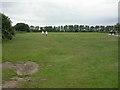
Stanpit Recreation Ground
Off Stanpit, maintained by Christchurch Borough Council, venue of firework displays, car boot sales & starting point of processions; popular with dog walkers (who all seem to arrive by car!) & cyclists.
Image: © Mike Faherty
Taken: 6 Aug 2009
0.11 miles
8

Path and entrance barrier
To Stanpit recreation ground.
Image: © David Lally
Taken: 3 Oct 2012
0.11 miles
9
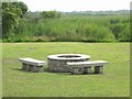
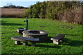
Tutton's Well at Stanpit
This well was at the centre of Stanpit village life for centuries. In 1885, the owner gave the well to the public as a clean water supply. It was capped in 1941, and all but disappeared. The Friends of Tutton’s Well was formed in 2002, and the restored well with stone seats, was opened in 2004. For more information see their website. http://www.tuttons-well.org.uk
Image: © mike smith
Taken: 13 Jul 2007
0.12 miles
10
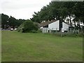
Stanpit, Sea Scouts HQ
Off Stanpit, on the eastern side of Image, TS Orestes, headquarters of 10th Christchurch Mudeford Sea Scout Group. http://www.christchurchscouts.org.uk/Mudeford/index.htm
Image: © Mike Faherty
Taken: 6 Aug 2009
0.12 miles