Tutton's Well at Stanpit
Introduction
The photograph on this page of Tutton's Well at Stanpit by mike smith as part of the Geograph project.
The Geograph project started in 2005 with the aim of publishing, organising and preserving representative images for every square kilometre of Great Britain, Ireland and the Isle of Man.

There are currently over 7.5m images from over 14,400 individuals and you can help contribute to the project by visiting https://www.geograph.org.uk
Tutton's Well at Stanpit
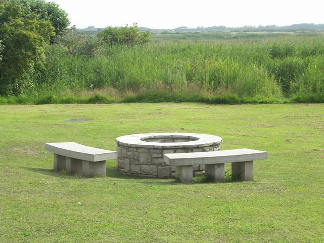
Image: © mike smith Taken: 13 Jul 2007
This well was at the centre of Stanpit village life for centuries. In 1885, the owner gave the well to the public as a clean water supply. It was capped in 1941, and all but disappeared. The Friends of Tutton’s Well was formed in 2002, and the restored well with stone seats, was opened in 2004. For more information see their website. http://www.tuttons-well.org.uk
Images are licensed for reuse under creativecommons.org/licenses/by-sa/2.0
Image Location


Leaflet Map data © OpenStreetMap
Latitude
50.730966
Longitude
-1.757658