
IMAGES TAKEN NEAR TO
Marlow Drive, CHRISTCHURCH, BH23 2UJ
Introduction
This page details the photographs taken nearby to Marlow Drive, BH23 2UJ by members of the Geograph project.
The Geograph project started in 2005 with the aim of publishing, organising and preserving representative images for every square kilometre of Great Britain, Ireland and the Isle of Man.

There are currently over 7.5m images from over14,400 individuals and you can help contribute to the project by visiting https://www.geograph.org.uk
Image Map
Images are licensed for reuse under creativecommons.org/licenses/by-sa/2.0
Notes
- Clicking on the map will re-center to the selected point.
- The higher the marker number, the further away the image location is from the centre of the postcode.
Image Listing (28 Images Found)
Images are licensed for reuse under creativecommons.org/licenses/by-sa/2.0
Image
Details
Distance
1
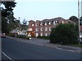
Christchurch: Catherine Wheel Gardens
This block of retirement flats is so named because it replaced the Catherine Wheel pub in the late 1980s.
Image: © Chris Downer
Taken: 2 Sep 2008
0.00 miles
2
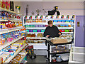
Interior of South African Shop, St Catherine's Hill, Christchurch, Dorset
On our way to Hengistbury Head found this shop selling lots of South African goodies. I was impressed with the colourful layout of the stock. The biltong is delicious. The three legged pot on the floor is a potje.
Image: © Clive Perrin
Taken: 9 Jun 2006
0.02 miles
3
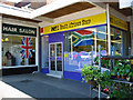
Exterior No one South African Shop St Catherines Hill Christchurch Dorset
Eye catching colour scheme.
Image: © Clive Perrin
Taken: 9 Jun 2006
0.02 miles
4

Path into nature reserve, Christchurch
A path leading into the St. Catherine's Hill Nature Reserve in Christchurch.
Image: © Malc McDonald
Taken: 12 Apr 2025
0.03 miles
5
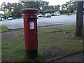
St. Catherine?s Hill: postbox № BH23 94, Marlow Drive
Behind the postbox, we are looking across the car park of Image The postbox was previously by the bench and bus shelter just visible far right; the postbox was moved here from alongside the shelter when the grocery store also became the post office.
Image: © Chris Downer
Taken: 2 Sep 2008
0.03 miles
7
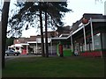
Christchurch: Marlow Drive shops
These shopfronts create an interesting zigzag shape. The end shop provides the third home of Town Common Post Office. It was a short way southeast, on the roundabout, until about 15 years ago; it then moved even farther southeast to the parade at Fairmile. It closed down for a while there before being reinstated here.
Image: © Chris Downer
Taken: 2 Sep 2008
0.04 miles
8
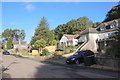
Houses on Hillside Drive
These houses are in a small residential cul-de-sac on the steep slopes of St Catherine's Hill.
Image: © Nigel Mykura
Taken: 7 Feb 2019
0.09 miles
9

Valley Close, Christchurch
Valley Close is a residential cul-de-sac in the St. Catherine's Hill district in Christchurch.
Image: © Malc McDonald
Taken: 12 Apr 2025
0.09 miles
10

Christchurch: Aston Mead
Aston Mead is the name of this road along the back edge of a sizeable estate of bungalows, behind which are the trees on the steep slope of St. Catherine's Hill.
Image: © Chris Downer
Taken: 2 Sep 2008
0.09 miles