
IMAGES TAKEN NEAR TO
Cross Way, CHRISTCHURCH, BH23 2TB
Introduction
This page details the photographs taken nearby to Cross Way, BH23 2TB by members of the Geograph project.
The Geograph project started in 2005 with the aim of publishing, organising and preserving representative images for every square kilometre of Great Britain, Ireland and the Isle of Man.

There are currently over 7.5m images from over14,400 individuals and you can help contribute to the project by visiting https://www.geograph.org.uk
Image Map
Images are licensed for reuse under creativecommons.org/licenses/by-sa/2.0
Notes
- Clicking on the map will re-center to the selected point.
- The higher the marker number, the further away the image location is from the centre of the postcode.
Image Listing (23 Images Found)
Images are licensed for reuse under creativecommons.org/licenses/by-sa/2.0
Image
Details
Distance
1
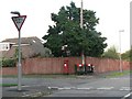
Jumpers: postbox № BH23 57, Hurn Way
Postboxes are frequently a magnet for graffiti, and this one, on the corner of Hurn Way and Cross Way, has had its slot blackened.
Image: © Chris Downer
Taken: 2 Sep 2008
0.08 miles
2
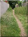
Ginnel to Recreation Ground from River Way/Cross Way
Useful shortcut used by many dog-walkers, etc, to the Rec and riverside. Taken in June 2008 just before the council workmen cut down all the grass!
Image: © Junette Robinson
Taken: Unknown
0.11 miles
3
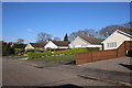
Houses on Links Drive
These houses are on Links Drive which backs on to the River Stour. The road gets its name from the golf course between the houses and the river.
Image: © Nigel Mykura
Taken: 7 Feb 2019
0.11 miles
4
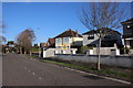
Houses on River Way (2)
Most of the houses on River Way are detached and many of them have been extensively extended and upgraded.
Image: © Nigel Mykura
Taken: 7 Feb 2019
0.12 miles
5

Hurn Way, Christchurch
Hurn Way is a minor residential road in Christchurch.
Image: © Malc McDonald
Taken: 12 Apr 2025
0.17 miles

7
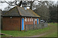
Public conveniences beside Stour Way
Open and operational - an increasingly rare public facility!
Image: © David Martin
Taken: 24 Jan 2022
0.18 miles
8
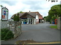
Holiday Park, near to Bournemouth
Meadowbank Holidays is a family run caravan park established in 1950.
Image: © Stuart Buchan
Taken: 28 May 2006
0.18 miles
9
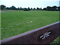
Jumpers: playing field alongside the Stour
This bench provides a view along/across the river Stour, just out of picture to the right.
The field is partially in the parishes of Christchurch and Hurn – although the boundary follows the river, here it diverts and does a loop around the field suggesting that the river had a more meandering course in years gone by.
The rather amusing plaque is in memory of Keith Woolnough, 4.1.1940 to 20.12.1999 – Gone Fishing!
Image: © Chris Downer
Taken: 31 Jul 2009
0.19 miles
10
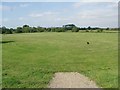
Recreation Ground
This public space is by the River Stour, and is popular with dog owners for exercising their pets.
Image: © mike smith
Taken: 24 Aug 2007
0.19 miles