IMAGES TAKEN NEAR TO
Oak Avenue, CHRISTCHURCH, BH23 2QD
Introduction
This page details the photographs taken nearby to Oak Avenue, BH23 2QD by members of the Geograph project.
The Geograph project started in 2005 with the aim of publishing, organising and preserving representative images for every square kilometre of Great Britain, Ireland and the Isle of Man.

There are currently over 7.5m images from over14,400 individuals and you can help contribute to the project by visiting https://www.geograph.org.uk
Image Map
Images are licensed for reuse under creativecommons.org/licenses/by-sa/2.0
Notes
- Clicking on the map will re-center to the selected point.
- The higher the marker number, the further away the image location is from the centre of the postcode.
Image Listing (65 Images Found)
Images are licensed for reuse under creativecommons.org/licenses/by-sa/2.0
Image
Details
Distance
1
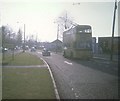
Bournemouth trolleybus at Jumpers Corner (1)
Sunbeam MF2B trolleybus travelling on route 20 to Christchurch taken in Barrack Road having crossed Iford Bridge. The vehicle dates from 1959 and has Weymann 63-seater bodywork.
Image: © David Hillas
Taken: 5 Apr 1969
0.03 miles
2
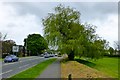
Willow beside the A35
Just the Christchurch side of Iford Bridge.
Image: © David Lally
Taken: 8 May 2013
0.05 miles
3
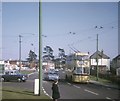
Bournemouth trolleybus at Jumpers Corner (2)
Sunbeam MF2B trolleybus 299 (299 LJ) on route 20 to Bournemouth taken in Barrack Road at the junction with Stourvale Avenue. The vehicle dates from 1962 and has Weymann 65-seater bodywork, it being one of the last batch of trolleybuses delivered to Bournemouth Corporation Transport, only to see less than seven years service in that town.
Image: © David Hillas
Taken: 5 Apr 1969
0.07 miles
4
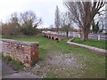
Iford bridges
The A35 is causewayed across the Stour flood plain towards the two arms of the river. On the left is the start of the parapet of the old bridge, shown in Image and Image
Image: © Derek Harper
Taken: 31 Mar 2010
0.08 miles
5
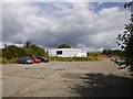
Iford Bridge Bowling Club
On Barrack Road, next to Iford (New) Bridge. http://ifordbridgebc.blogspot.co.uk/
Image: © Mike Faherty
Taken: 23 Aug 2012
0.09 miles

7
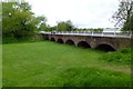
Iford bridge
The "new" bridge carrying the A35 over the River Stour. here over the currently dry eastern channel.
Image: © David Lally
Taken: 8 May 2013
0.11 miles
8
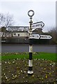
Direction Sign - Signpost by the A35, Barrack Road, Christchurch
Annulus finial - 4 arms; Hampshire Parish halo by the A35, in parish of Christchurch (Christchurch District), Barrack Road, junction with The Grove, at centre of Jumpers Roundabout.
Surveyed
Milestone Society National ID: HA_SZ1493
Image: © Milestone Society
Taken: Unknown
0.11 miles
9

Bournemouth : Barrack Road
Barrack Road has an Esso Petrol Station
Image: © Lewis Clarke
Taken: 6 Jun 2008
0.12 miles