
IMAGES TAKEN NEAR TO
Grove Road East, CHRISTCHURCH, BH23 2DQ
Introduction
This page details the photographs taken nearby to Grove Road East, BH23 2DQ by members of the Geograph project.
The Geograph project started in 2005 with the aim of publishing, organising and preserving representative images for every square kilometre of Great Britain, Ireland and the Isle of Man.

There are currently over 7.5m images from over14,400 individuals and you can help contribute to the project by visiting https://www.geograph.org.uk
Image Map
Images are licensed for reuse under creativecommons.org/licenses/by-sa/2.0
Notes
- Clicking on the map will re-center to the selected point.
- The higher the marker number, the further away the image location is from the centre of the postcode.
Image Listing (54 Images Found)
Images are licensed for reuse under creativecommons.org/licenses/by-sa/2.0
Image
Details
Distance
1
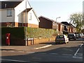
Christchurch: postbox № BH23 24, Fairmile Road
Looking along Grove Road East from across Fairmile Road, with this Elizabeth II-reign postbox on the corner which is emptied finally at 5:30pm on weekdays and at 12:15pm on Saturdays.
Image: © Chris Downer
Taken: 23 Jun 2009
0.07 miles
2
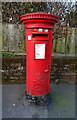
Elizabeth II postbox on Fairmile Road
Postbox No. BH23 24.
Image: © JThomas
Taken: 23 Mar 2022
0.08 miles
3
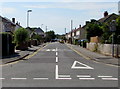
West along Portfield Road, Christchurch
Viewed across Fairmile Road. The speed limit is 20mph along Portfield Road, and there are speed bumps ahead on the approach to Christchurch Infant School and Christchurch Junior School.
Image: © Jaggery
Taken: 24 Aug 2016
0.11 miles
4
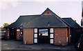
Christchurch Family Church
The building is known as Hope House.
Image: © Michael FORD
Taken: Unknown
0.11 miles
6
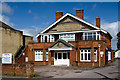
Christchurch: former Drill Hall, Portfield Road
Former Drill Hall of the 7th Battalion, Hampshire Regiment (B Company). Now a Community Centre.
Image: © Mike Searle
Taken: 10 May 2014
0.12 miles
7
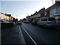
Portfield Road, looking north-east
Portfield Road at first glance appears to be a street of uniform semi-detached houses, but on closer inspection they turn out to be built in a variety of styles. The northeastern end of the road appears to be largely early 20th century. Note the patterned brickwork on the house on the right; its partner has been whitewashed.
Image: © HelenK
Taken: 17 Feb 2019
0.12 miles
8
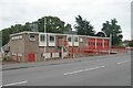
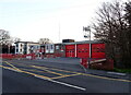
Christchurch Fire Station
Christchurch Fire Station, Fairmile Road, Christchurch, Dorset.
Image: © Kevin Hale
Taken: 27 Sep 2006
0.12 miles
9
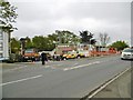
Christchurch Fire Station
On Fairmile Road. Today was the station's open day, with an impressive exhibition of hardware and demonstrations: http://www.dorsetfire.gov.uk/events/christchurch-open-day/
Image: © Mike Faherty
Taken: 26 Apr 2015
0.12 miles
10
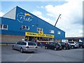
Christchurch: Peeks Party Store
A store for events and parties selling costumes and such
Image: © Lewis Clarke
Taken: 6 Jun 2008
0.15 miles