
IMAGES TAKEN NEAR TO
Livingstone Road, CHRISTCHURCH, BH23 1HL
Introduction
This page details the photographs taken nearby to Livingstone Road, BH23 1HL by members of the Geograph project.
The Geograph project started in 2005 with the aim of publishing, organising and preserving representative images for every square kilometre of Great Britain, Ireland and the Isle of Man.

There are currently over 7.5m images from over14,400 individuals and you can help contribute to the project by visiting https://www.geograph.org.uk
Image Map
Images are licensed for reuse under creativecommons.org/licenses/by-sa/2.0
Notes
- Clicking on the map will re-center to the selected point.
- The higher the marker number, the further away the image location is from the centre of the postcode.
Image Listing (45 Images Found)
Images are licensed for reuse under creativecommons.org/licenses/by-sa/2.0
Image
Details
Distance
1
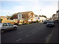
Junction of Purewell and The Buttery
A clear and sunny day on the narrow but busy Purewell.
The old road from Christchurch to Southampton.
Image: © Simon Scurr
Taken: 7 Feb 2007
0.05 miles
2
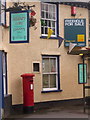
Christchurch: postbox № BH23 16, Purewell
A George VI-reign postbox standing outside the Image, emptied finally at 5:30pm on weekdays and at 12:30pm on Saturdays.
Image: © Chris Downer
Taken: 30 Jun 2009
0.09 miles
3
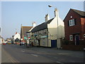
Purewell, The Salisbury Arms
Open-plan pub with L-shaped bar , 2 drinking areas, pool & darts & surprisingly large garden/patio. Cask ale on offer at my visit: Ringwood Best. For some customer reviews, see http://www.beerintheevening.com/pubs/s/26/2691/Salisbury_Arms/Christchurch
Image: © Mike Faherty
Taken: 18 Mar 2009
0.09 miles
4
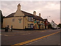
Christchurch: the Salisbury Arms
A pub which appears to have recently closed and is up for sale. I seem to remember it had a circular pool table in one corner – it was snug in the corner and the table rotated until you could play your desired shot!
Image: © Chris Downer
Taken: 30 Jun 2009
0.10 miles
5
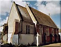
Roman Catholic Church of Immaculate Conception & St. Joseph at Purewell
Erected in 1866. It has been replaced by a new church adjacent.
Image: © Michael FORD
Taken: Unknown
0.10 miles
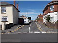
7
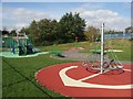
Playground at Scotts Hill Lane
Just off Purwell Cross Road, this is a safe play area for children living on the adjacent new housing developments.
Image: © mike smith
Taken: 21 Oct 2007
0.10 miles
9
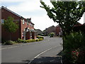
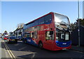
Purewell, Le Patourel Close
Modern housing off Normandy Drive; probably named after Herbert Le Patourel, VC-awarded officer in the Hampshire Regiment in 1942.
Image: © Mike Faherty
Taken: 27 Jun 2010
0.11 miles
10
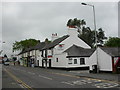
Purewell, Rising Sun
Pub and Thai restaurant on Purewell. Internally, L-shaped bar, with drinking areas on three sides, Mr. Poon's restaurant to the back, patio & garden. Cask ales on offer at my visit: Ringwood Best, Fortyniner. For some customer comments, see http://www.beerintheevening.com/pubs/s/26/2690/Rising_Sun/Christchurch
Image: © Mike Faherty
Taken: 10 Jun 2010
0.11 miles