
IMAGES TAKEN NEAR TO
Glenwood Close, FERNDOWN, BH22 0ES
Introduction
This page details the photographs taken nearby to Glenwood Close, BH22 0ES by members of the Geograph project.
The Geograph project started in 2005 with the aim of publishing, organising and preserving representative images for every square kilometre of Great Britain, Ireland and the Isle of Man.

There are currently over 7.5m images from over14,400 individuals and you can help contribute to the project by visiting https://www.geograph.org.uk
Image Map
Images are licensed for reuse under creativecommons.org/licenses/by-sa/2.0
Notes
- Clicking on the map will re-center to the selected point.
- The higher the marker number, the further away the image location is from the centre of the postcode.
Image Listing (35 Images Found)
Images are licensed for reuse under creativecommons.org/licenses/by-sa/2.0
Image
Details
Distance
1
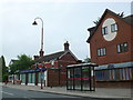
Station Road.
This Village Medical Practice in Station Rd, West Moors. This is the main road through West Moors and runs from Three Legged Cross to Ferndown.
Image: © Nigel Mykura
Taken: 27 Jun 2012
0.10 miles
3
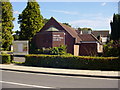
United Reformed Church - West Moors
This building (mostly) dates from the 1970s; a 'Congregational' church was built on this site in 1903 when West Moors was about to undergo its first (of many) spurts of development - later becoming part of the URC movement. The church lies centrally in the village, on the corner of Station Road and Moorlands Road here in West Moors. It is known formally as "St. Martin's, West Moors".
Image: © Martin Rowley
Taken: 12 Sep 2012
0.10 miles
4
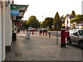
West Moors: postbox № BH22 15, Station Road
This George VI-reign postbox stands outside the Image, facing the Spar convenience store which is also the village post office, which had been a bit farther north of here till a few years ago (see Image).
Image: © Chris Downer
Taken: 15 Jun 2009
0.10 miles
5
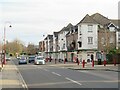
Station Road, West Moors
Station Road is the main road through the town of West Moors in Dorset. Its name is a clue that West Moors used to have a railway station. Trains no longer serve West Moors, as the station closed to passengers in 1964.
The road is on the route of the B3072.
Image: © Malc McDonald
Taken: 9 Mar 2025
0.10 miles
6
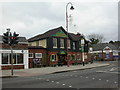
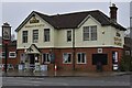
West Moors, The Elephant and Castle
Pub on Station Road. Internally, L-shaped bar, with drinking & eating areas on three sides. Cask ales on offer at my visit: Ringwood Best & Fortyniner, Banks's Bitter. For some customer comments, see http://www.beerintheevening.com/pubs/s/27/2787/Elephant_and_Castle/West_Moors
Image: © Mike Faherty
Taken: 31 Dec 2009
0.11 miles
7
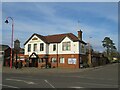
Elephant & Castle pub, West Moors
The Elephant & Castle pub in the town of West Moors in Dorset. The pub is one of the Marston's chain.
Image: © Malc McDonald
Taken: 9 Mar 2025
0.11 miles
8
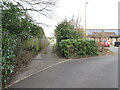
Castleman Trailway, West Moors
This narrow alley in West Moors is on the route of the Castleman Trailway (green sign to the right of the path) and National Cycle Network route 256 (blue sign to the left).
This alley, and the housing either side, are on the site of West Moors railway station. The station closed to passengers in 1964, as part of the "Beeching Cuts". The railway line to West Moors continued in use for freight traffic until 1974. See the Disused Stations website: http://www.disused-stations.org.uk/w/west_moors/index.shtml for more details about West Moors station.
Image: © Malc McDonald
Taken: 9 Mar 2025
0.11 miles
9
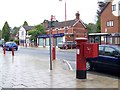
George V Postbox, West Moors
In Station Road.
Image: © Maigheach-gheal
Taken: 5 Sep 2008
0.11 miles
10
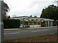
West Moors Library
On Station Road, at the junction with Moorlands Road. http://www.westmoorsdorset.co.uk/library_services.htm
Image: © Mike Faherty
Taken: 31 Dec 2009
0.11 miles