
IMAGES TAKEN NEAR TO
Uplands Road, FERNDOWN, BH22 0BA
Introduction
This page details the photographs taken nearby to Uplands Road, BH22 0BA by members of the Geograph project.
The Geograph project started in 2005 with the aim of publishing, organising and preserving representative images for every square kilometre of Great Britain, Ireland and the Isle of Man.

There are currently over 7.5m images from over14,400 individuals and you can help contribute to the project by visiting https://www.geograph.org.uk
Image Map
Images are licensed for reuse under creativecommons.org/licenses/by-sa/2.0
Notes
- Clicking on the map will re-center to the selected point.
- The higher the marker number, the further away the image location is from the centre of the postcode.
Image Listing (24 Images Found)
Images are licensed for reuse under creativecommons.org/licenses/by-sa/2.0
Image
Details
Distance
2
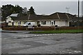
Junction of Southern Road and Uplands Road
Typical bungalow street scene in West Moors.
Image: © David Martin
Taken: 10 Jan 2022
0.10 miles
3
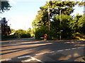
West Moors: postbox № BH22 136, Pinehurst Road
This George VI-reign postbox is set into a brick pillar on the corner of Pinehurst and Abbey Roads. Its final collection times are 5pm on weekdays and noon on Saturdays.
Image: © Chris Downer
Taken: 15 Jun 2009
0.12 miles
4
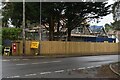
New infill housing beside Pinehurst Road
Image: © David Martin
Taken: 10 Jan 2022
0.13 miles
5
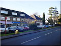
Pinehurst Road West Moors - Shops A31 end
Moving a little up the road to take in the 'other' end of the parade of shops & also showing the bus stop: this latter services Wilts & Dorset and Yellow Bus (as at December 2011) buses travelling towards the main village centre, and in the case of the W&D buses, on to Three-Legged Cross and Verwood. To the right of the scrubby bush can be seen the Parish noticeboard - one of many dotted around the community.
Image: © Martin Rowley
Taken: 16 Dec 2011
0.14 miles
6
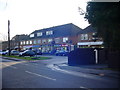
Pinehurst Road West Moors - Shops A31 end
This view of the 'Ringwood Road/A31' end of Pinehurst Road, West Moors shows the other end of the access road and takes in (just) all the shop units on this parade. These shops serve two purposes - (a) act as a local shopping area for the area of West Moors that developed since the Second World War well away from the old village centre and (b) captures passing trade on the A31.
Image: © Martin Rowley
Taken: 16 Dec 2011
0.14 miles
7
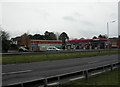
St Leonards, service station
Service station, convenience store and tyre depot on Ringwood Road at the corner of Pinehurst Road.
Image: © Mike Faherty
Taken: 27 Nov 2010
0.15 miles
8
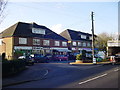
Pinehurst Road West Moors - Shops A31 end
These are part of the parade of shops at the Ringwood Road (A31) end of Pinehurst Road in West Moors, Dorset. The road runs NW/SE at this point, and this shot shows the 'south-eastern' end of the parade of shops, showing the entry to the access loop. It is difficult to get a 'whole parade' shot due to the numbers of vehicles parking at this point; there are also flats above the shops. [December 2011]
Image: © Martin Rowley
Taken: 16 Dec 2011
0.15 miles
9
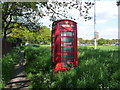
West Moors: phone box on the A31
This red K6 phone box stands alongside the busy A31, at the entrance to a lay-by (visible to the left) which follows the original course of the road.
Image: © Chris Downer
Taken: 18 May 2013
0.15 miles
10
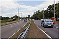
A31 dual carriageway approaching Trickett's Cross
A very busy road. This is taken from the central reservation just west of a roundabout. I had to wait several minutes before I could run across the road.
Image: © Peter Facey
Taken: 2 Aug 2010
0.17 miles