IMAGES TAKEN NEAR TO
Lower Rowe, WIMBORNE, BH21 7DZ
Introduction
This page details the photographs taken nearby to Lower Rowe, BH21 7DZ by members of the Geograph project.
The Geograph project started in 2005 with the aim of publishing, organising and preserving representative images for every square kilometre of Great Britain, Ireland and the Isle of Man.

There are currently over 7.5m images from over14,400 individuals and you can help contribute to the project by visiting https://www.geograph.org.uk
Image Map (Loading...)


Getting Data...Please wait
Leaflet Map data © OpenStreetMap
Images are licensed for reuse under creativecommons.org/licenses/by-sa/2.0
Notes
- Clicking on the map will re-center to the selected point.
- The higher the marker number, the further away the image location is from the centre of the postcode.
Image Listing (17 Images Found)
Images are licensed for reuse under creativecommons.org/licenses/by-sa/2.0
Image
Details
Distance
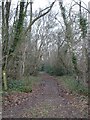
1
Lower Row, bridleway junction
From Broad Lawn; ahead, to Holt Lodge; left, to Holt Forest; right, to Lower Row.
Image: © Mike Faherty
Taken: 16 May 2013
0.03 miles
2
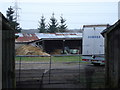
Horse stables on Lower Row Farm
Horses fitted with Anti-theft devices!
Image: © Toby
Taken: 26 Dec 2006
0.08 miles
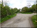
4
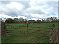
Broken Gate
Looking past the broken gate, towards Lower Row Farm. We were standing between Lower Row and Broad Lawn.
Image: © Lorraine and Keith Bowdler
Taken: 10 Feb 2010
0.12 miles
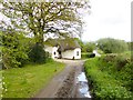
5
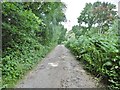
Holt, bridleway
Bridleway and farm road, from Higher Row to Ferndown Forest.
Image: © Mike Faherty
Taken: 11 Jul 2020
0.13 miles
6
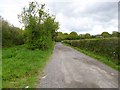
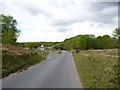
Broad Lawn, bridleway
From Broad Lawn to Holt Lodge, also serving as access to local houses.
Image: © Mike Faherty
Taken: 16 May 2013
0.15 miles
7
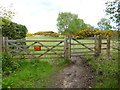
Lower Row, gate No 19
On the route from Image to National Trust open heathland.
Image: © Mike Faherty
Taken: 16 May 2013
0.17 miles
8
Holt Heath, cattle grid
Leaving the open heath, where cattle graze to help control scrubland.
Image: © Mike Faherty
Taken: 16 May 2013
0.17 miles
9
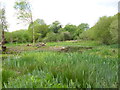
Holt Forest, pond
At the eastern end of the National Trust's nature reserve.
Image: © Mike Faherty
Taken: 16 May 2013
0.20 miles