
IMAGES TAKEN NEAR TO
Gods Blessing Lane, WIMBORNE, BH21 7DF
Introduction
This page details the photographs taken nearby to Gods Blessing Lane, BH21 7DF by members of the Geograph project.
The Geograph project started in 2005 with the aim of publishing, organising and preserving representative images for every square kilometre of Great Britain, Ireland and the Isle of Man.

There are currently over 7.5m images from over14,400 individuals and you can help contribute to the project by visiting https://www.geograph.org.uk
Image Map
Images are licensed for reuse under creativecommons.org/licenses/by-sa/2.0
Notes
- Clicking on the map will re-center to the selected point.
- The higher the marker number, the further away the image location is from the centre of the postcode.
Image Listing (17 Images Found)
Images are licensed for reuse under creativecommons.org/licenses/by-sa/2.0
Image
Details
Distance
1
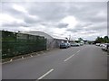
God's Blessing Green, Stewarts
Garden centre on Blessing Lane. The attached nursery is in Image http://www.stewarts.co.uk/
Image: © Mike Faherty
Taken: 15 Jun 2014
0.04 miles
2
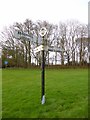
Old Direction Sign - Signpost by Hart's Lane, God's Blessing Green
Annulus and bar finial - 3 arms; Dorset halo with NGR by the UC road, in parish of Holt (East Dorset District), God's Blessing Green, junction of UC road to Pig Oak, on green opposite garden centre.
Surveyed
Milestone Society National ID: DO_SU0303
Image: © Milestone Society
Taken: Unknown
0.06 miles
3
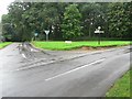
Holt: God?s Blessing Green
A little green with a charming name, on the corner of God’s Blessing Lane (left).
Image: © Chris Downer
Taken: 31 Aug 2008
0.07 miles
4
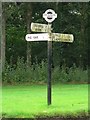
Holt: God?s Blessing Green sign
Detail of the finger post on Image, showing the finial with location and grid reference to six digits.
For a close-up of the finial, see Image
Image: © Chris Downer
Taken: 31 Aug 2008
0.07 miles
5
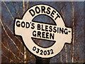
Holt: God?s Blessing Green signpost detail
A close-up of the finial from the finger-post (see Image), giving location and grid reference details.
Image: © Chris Downer
Taken: 7 Mar 2010
0.07 miles
6
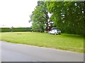
God's Blessing Green, green
Registered green at the corner of Blessing Lane and Hart's Lane. The location is thought to derive its name from blessings given to Parliamentarian troops in the Civil War.
Note travellers' encampment - traditional caravan, horse, two dogs and two vehicles.
Image: © Mike Faherty
Taken: 15 Jun 2014
0.07 miles
7
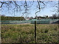
God's Blessing Green, nursery
Stewarts Nursery, seen from the footpath to Long Lane. http://www.stewarts.co.uk/index.php?option=com_content&view=article&id=64&Itemid=60
Image: © Mike Faherty
Taken: 19 Mar 2011
0.11 miles
8
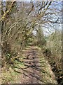
God's Blessing Green, footpath
From Long Lane to God's Blessing Green; Martin's Close Copse to left, Stewarts Nursery to right.
Image: © Mike Faherty
Taken: 19 Mar 2011
0.11 miles
9
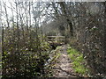
God's Blessing Green, footbridge
A sturdy wooden footbridge over a stream, on the footpath to Long Lane.
Image: © Mike Faherty
Taken: 19 Mar 2011
0.12 miles
10
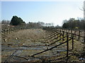
God's Blessing Green, nursery
Stewarts Nursery, seen from the footpath to Long Lane. http://www.stewarts.co.uk/index.php?option=com_content&view=article&id=64&Itemid=60
Image: © Mike Faherty
Taken: 19 Mar 2011
0.14 miles