
IMAGES TAKEN NEAR TO
Holt, WIMBORNE, BH21 7DB
Introduction
This page details the photographs taken nearby to BH21 7DB by members of the Geograph project.
The Geograph project started in 2005 with the aim of publishing, organising and preserving representative images for every square kilometre of Great Britain, Ireland and the Isle of Man.

There are currently over 7.5m images from over14,400 individuals and you can help contribute to the project by visiting https://www.geograph.org.uk
Image Map
Images are licensed for reuse under creativecommons.org/licenses/by-sa/2.0
Notes
- Clicking on the map will re-center to the selected point.
- The higher the marker number, the further away the image location is from the centre of the postcode.
Image Listing (12 Images Found)
Images are licensed for reuse under creativecommons.org/licenses/by-sa/2.0
Image
Details
Distance
1
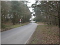
Holt Heath, cattle grid
On the minor road from Broom Hill to Higher Row; preventing free-roaming cattle and horses on Holt Heath from wandering away from the nature reserve.
Image: © Mike Faherty
Taken: 29 Mar 2011
0.06 miles
2
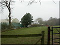
Holt Heath, glasshouses
At Pillmoor Farm.
Image: © Mike Faherty
Taken: 29 Mar 2011
0.12 miles
3
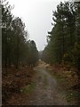
White Sheet Plantation, forestry road
Conifer gloom slightly attenuated by gorse flowers.
Image: © Mike Faherty
Taken: 29 Mar 2011
0.13 miles
4
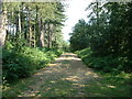
White Sheet Hill
View looking south east
Image: © John Smitten
Taken: 8 Aug 2005
0.14 miles
5
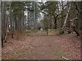
Holt Heath, gate
National Trust land this side; Forestry Commission the other, with White Sheet Hill Car Park to the left.
Image: © Mike Faherty
Taken: 29 Mar 2011
0.15 miles
6

Path through the woods near White Sheet Hill car park
Image: © David Martin
Taken: 15 Jan 2022
0.16 miles
7
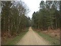
White Sheet Hill
Looking up towards the highest point from the plantation.
Image: © Mike Faherty
Taken: 29 Mar 2011
0.17 miles
8
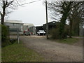
Holt, farm buildings
Polytunnels and a barn at Pillmoor Farm.
Image: © Mike Faherty
Taken: 29 Mar 2011
0.19 miles
9
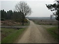
Holt Heath, forestry road junction
From White Sheet Hill; ahead, across cleared woodland in Holt Heath; left, towards Higher Row; right, towards Uddens Water.
Image: © Mike Faherty
Taken: 29 Mar 2011
0.20 miles
10
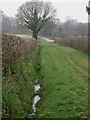
Holt, Pillmoor Bottom
A shallow depression West of Holt Heath; seen here from one of the local network of bridleways.
Image: © Mike Faherty
Taken: 29 Mar 2011
0.22 miles