IMAGES TAKEN NEAR TO
Sandhurst Drive, WIMBORNE, BH21 6SQ
Introduction
This page details the photographs taken nearby to Sandhurst Drive, BH21 6SQ by members of the Geograph project.
The Geograph project started in 2005 with the aim of publishing, organising and preserving representative images for every square kilometre of Great Britain, Ireland and the Isle of Man.

There are currently over 7.5m images from over14,400 individuals and you can help contribute to the project by visiting https://www.geograph.org.uk
Image Map
Images are licensed for reuse under creativecommons.org/licenses/by-sa/2.0
Notes
- Clicking on the map will re-center to the selected point.
- The higher the marker number, the further away the image location is from the centre of the postcode.
Image Listing (9 Images Found)
Images are licensed for reuse under creativecommons.org/licenses/by-sa/2.0
Image
Details
Distance
1
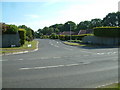
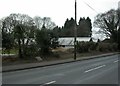
Three Legged Cross, Dorset
Residential area on the Woolsbridge Road.
Image: © Stuart Buchan
Taken: 11 Jun 2006
0.01 miles
2
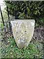
Old Boundary Marker by Ringwood Road, Three Legged Cross, Verwood parish
Estate Boundary Marker - War Department by the UC road, in parish of Verwood (East Dorset District), Ringwood Road, Three Legged Cross, at gated entrance 250m East of the junction with School Lane by the hedge.
Inscription reads:-
W^D
BS
19
Surveyed
Milestone Society National ID: DO_WDWMO19em
Image: © Milestone Society
Taken: Unknown
0.05 miles
3
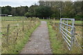
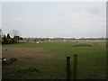
Three Legged Cross, Lower Common Lane
Lane with bridleway from Ringwood Road to commercial and residential properties, and grazing land.
Image: © Mike Faherty
Taken: 29 Mar 2011
0.06 miles
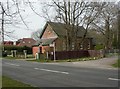
4
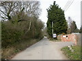
Three Legged Cross, poultry houses
On Ringwood Road; apparently disused.
Image: © Mike Faherty
Taken: 29 Mar 2011
0.09 miles
6
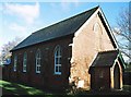
Three Legged Cross: United Reformed Church
Image: © Chris Downer
Taken: Unknown
0.18 miles
7
Three Legged Cross, URC
On Ringwood Road.
Image: © Mike Faherty
Taken: 29 Mar 2011
0.20 miles
8
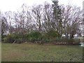
Pond On Lower Common
This pond is no longer accessible as the path has been re-routed. However, the stile can be seen behind the tape fencing.
Image: © Lorraine and Keith Bowdler
Taken: 12 Feb 2012
0.21 miles