Old Boundary Marker by Ringwood Road, Three Legged Cross, Verwood parish
Introduction
The photograph on this page of Old Boundary Marker by Ringwood Road, Three Legged Cross, Verwood parish by Milestone Society as part of the Geograph project.
The Geograph project started in 2005 with the aim of publishing, organising and preserving representative images for every square kilometre of Great Britain, Ireland and the Isle of Man.

There are currently over 7.5m images from over 14,400 individuals and you can help contribute to the project by visiting https://www.geograph.org.uk
Old Boundary Marker by Ringwood Road, Three Legged Cross, Verwood parish
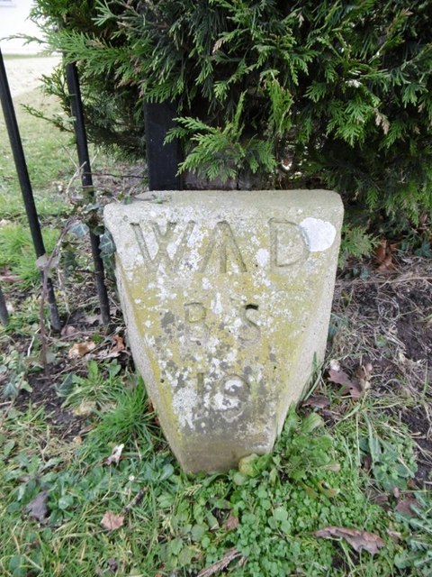
Image: © Milestone Society Taken: Unknown
Estate Boundary Marker - War Department by the UC road, in parish of Verwood (East Dorset District), Ringwood Road, Three Legged Cross, at gated entrance 250m East of the junction with School Lane by the hedge. Inscription reads:- W^D BS 19 Surveyed Milestone Society National ID: DO_WDWMO19em
Images are licensed for reuse under creativecommons.org/licenses/by-sa/2.0
Image Location
Latitude
50.846611
Longitude
-1.8718