
IMAGES TAKEN NEAR TO
Cranborne, WIMBORNE, BH21 5RX
Introduction
This page details the photographs taken nearby to BH21 5RX by members of the Geograph project.
The Geograph project started in 2005 with the aim of publishing, organising and preserving representative images for every square kilometre of Great Britain, Ireland and the Isle of Man.

There are currently over 7.5m images from over14,400 individuals and you can help contribute to the project by visiting https://www.geograph.org.uk
Image Map
Images are licensed for reuse under creativecommons.org/licenses/by-sa/2.0
Notes
- Clicking on the map will re-center to the selected point.
- The higher the marker number, the further away the image location is from the centre of the postcode.
Image Listing (19 Images Found)
Images are licensed for reuse under creativecommons.org/licenses/by-sa/2.0
Image
Details
Distance
1
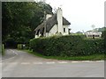
Boveridge: centre of village
The old Dorset fingerpost, with finial which includes location and grid reference, has had a recent cycle route sign added.
For a close-up of the finial, see Image
Image: © Chris Downer
Taken: 31 Aug 2008
0.02 miles
2

Cock Pheasant (Phasianus colchicus)
Among the most numerous of game birds, pheasants provide sport by flying strongly and directly over guns. When otherwise disturbed, they tend to run away rather than fly. Rearing and protecting them, organising shoots has become a major rural industry.
Pheasants, first recorded in England in 1059, are now widespread throughout Britain and Ireland. One theory is that they were introduced by the Romans from Asia. The common pheasant derives from the Chinese ring-necked, black-necked and Mongolian breeds, and accordingly varies in plumage. This has produced two forms - those with a white neck-ring and those without.
Pheasants are ground dwelling birds, vulnerable to foxes, stoats, weasels and other predators. Due to the efforts of gamekeepers, who also supply winter feeding, pheasants survive in larger numbers than would be possible if they were left to fend for themselves.
Image: © Maigheach-gheal
Taken: 16 Apr 2010
0.02 miles
3

Finger post, Boveridge
Finger post with grid reference on the roundel.
Image: © Maigheach-gheal
Taken: 31 Jan 2010
0.02 miles
4

Boveridge: finger-post detail
A close-up of the finial of the finger-post (see Image), giving location and grid reference details.
Image: © Chris Downer
Taken: 7 Mar 2010
0.02 miles
5

Old Direction Sign - Signpost by Boveridge, Cranborne Parish
Annulus & bar finial - 4 arms; Dorset halo with NGR by the UC road, in parish of Cranborne (East Dorset District), Boveridge, at crossroads junction of UC roads to West Blagdon and Damerham, in hedge.
Surveyed
Milestone Society National ID: DO_SU0514
Image: © Milestone Society
Taken: Unknown
0.03 miles
6

Sign, Boveridge
The roundel has the name of the hamlet on it and also a six figure grid reference. For a wider view of the sign Image
Image: © Maigheach-gheal
Taken: 16 Apr 2010
0.04 miles
7

Track at Boveridge Dorset
Going north west towards Toby's Bottom through rich arable fields.
Image: © Clive Perrin
Taken: 29 Aug 2005
0.07 miles
8
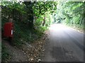
Boveridge: postbox № BH21 114 and leafy lane
Postbox number BH21 114 stands alongside this lane through the village of Boveridge.
Image: © Chris Downer
Taken: 31 Aug 2008
0.08 miles
9

Farm track, Boveridge
The farm track also acts as a public footpath.
Image: © Maigheach-gheal
Taken: 4 Aug 2010
0.09 miles
10

Harvested field, Boveridge
The crop is only partly cut and the straw is waiting to be baled.
Image: © Maigheach-gheal
Taken: 4 Aug 2010
0.10 miles