IMAGES TAKEN NEAR TO
Wimborne St. Giles, WIMBORNE, BH21 5NR
Introduction
This page details the photographs taken nearby to BH21 5NR by members of the Geograph project.
The Geograph project started in 2005 with the aim of publishing, organising and preserving representative images for every square kilometre of Great Britain, Ireland and the Isle of Man.

There are currently over 7.5m images from over14,400 individuals and you can help contribute to the project by visiting https://www.geograph.org.uk
Image Map (Loading...)


Getting Data...Please wait
Leaflet Map data © OpenStreetMap
Images are licensed for reuse under creativecommons.org/licenses/by-sa/2.0
Notes
- Clicking on the map will re-center to the selected point.
- The higher the marker number, the further away the image location is from the centre of the postcode.
Image Listing (13 Images Found)
Images are licensed for reuse under creativecommons.org/licenses/by-sa/2.0
Image
Details
Distance
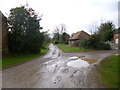
5
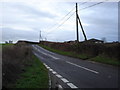
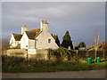
Parsonage Lane towards Glebe Farm
and on into Wimborne St Giles
Image: © Toby
Taken: 5 Jan 2007
0.11 miles
6
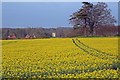
Wimborne St Giles across Oilseed Rape field
Image: © Simon Barnes
Taken: 6 Apr 2007
0.17 miles
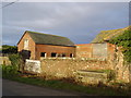
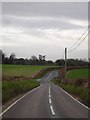
8
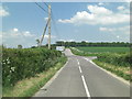
Junction of B3081 with Parsonage Lane
which becomes the B3081
Image: © Toby
Taken: 5 Jan 2007
0.20 miles
9
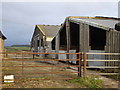
Wimborne St Giles, farm road
Leading to Home Farm.
Image: © Mike Faherty
Taken: 8 Feb 2013
0.23 miles
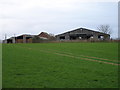
10
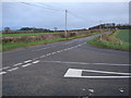
Parsonage Lane
This part is B3081 which then turns the corner while the lane continues straight
Image: © Toby
Taken: 5 Jan 2007
0.23 miles