
IMAGES TAKEN NEAR TO
Brockington, WIMBORNE, BH21 5LU
Introduction
This page details the photographs taken nearby to BH21 5LU by members of the Geograph project.
The Geograph project started in 2005 with the aim of publishing, organising and preserving representative images for every square kilometre of Great Britain, Ireland and the Isle of Man.

There are currently over 7.5m images from over14,400 individuals and you can help contribute to the project by visiting https://www.geograph.org.uk
Image Map
Images are licensed for reuse under creativecommons.org/licenses/by-sa/2.0
Notes
- Clicking on the map will re-center to the selected point.
- The higher the marker number, the further away the image location is from the centre of the postcode.
Image Listing (6 Images Found)
Images are licensed for reuse under creativecommons.org/licenses/by-sa/2.0
Image
Details
Distance
1
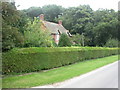
Brockington Down, Beech Lodge
On the minor road from Wimborne St Giles to Gussage All Saints; nearby woods are in fact full of beech trees.
Image: © Mike Faherty
Taken: 10 Aug 2009
0.05 miles
2
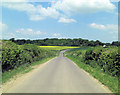
Lane northwest of Brockington Farm
It's always difficult to know exactly at which point the name transition occurs on a country lane. Behind us is Custard Hill and beyond the junction Baileys Hill. The white signpost marks the junction with Lumber Lane.
Image: © Stuart Logan
Taken: 4 Jun 2013
0.07 miles
3
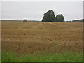
Brockington Down, harvested field
As seen from the road from Wimborne St Giles to Gussage All Saints.
Image: © Mike Faherty
Taken: 10 Aug 2009
0.12 miles
4
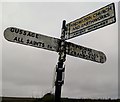
Direction Sign ? Signpost
Located on the northwest side of the T junction of Bailey's Hill and Lumber Lane in Gussage All Saints parish. 4 arms, 1 missing and I worboys, and lost finial.
Milestone Society National ID: DO_SU0111
Image: © S Day
Taken: 14 Dec 2019
0.19 miles
5
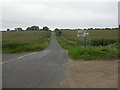
Brockington, fingerpost
Traditional Dorset fingerpost, albeit without a finial, on the minor road from Wimborne St Giles to Gussage All Saints; road to Knowlton to the left, maize fields to the left & right.
Image: © Mike Faherty
Taken: 10 Aug 2009
0.19 miles
6
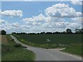
Turning for Knowleton Church and earthworks
Image: © Sarah Charlesworth
Taken: 31 May 2011
0.19 miles