IMAGES TAKEN NEAR TO
Witchampton, WIMBORNE, BH21 5DD
Introduction
This page details the photographs taken nearby to BH21 5DD by members of the Geograph project.
The Geograph project started in 2005 with the aim of publishing, organising and preserving representative images for every square kilometre of Great Britain, Ireland and the Isle of Man.

There are currently over 7.5m images from over14,400 individuals and you can help contribute to the project by visiting https://www.geograph.org.uk
Image Map (Loading...)


Getting Data...Please wait
Leaflet Map data © OpenStreetMap
Images are licensed for reuse under creativecommons.org/licenses/by-sa/2.0
Notes
- Clicking on the map will re-center to the selected point.
- The higher the marker number, the further away the image location is from the centre of the postcode.
Image Listing (15 Images Found)
Images are licensed for reuse under creativecommons.org/licenses/by-sa/2.0
Image
Details
Distance
3
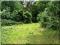
The Oaks
The area of woodland called the Oaks is at the present time closed to the public as cattle are grazing to clear the unwanted undergrowth.
Image: © Maigheach-gheal
Taken: 28 Jul 2009
0.12 miles
4
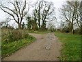
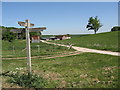
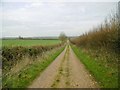
Pamphill, bridleway junction
Left, to Blandford Road; ahead, to Witchampton.
Image: © Mike Faherty
Taken: 19 Dec 2015
0.12 miles
5
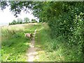
Bridleway, The Oaks
The bridleway runs along the edge field edge of the Oaks.
Image: © Maigheach-gheal
Taken: 28 Jul 2009
0.15 miles
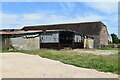
6
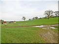
Track Intersection, King Down Farm
This intersection is close to Badbury Rings and is on the edge of Kingston Lacy Estate.
Image: © Stuart Buchan
Taken: 2 May 2007
0.16 miles
7
Badbury, bridleway junction
Left, Heron Drove, to Witchampton; right, King Down Drove, to Blandford Road.
Image: © Mike Faherty
Taken: 19 Dec 2015
0.16 miles
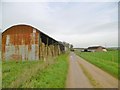
8
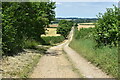
Hardy Way on farm track north of King Down Farm
Image: © David Martin
Taken: 10 Jul 2022
0.16 miles
9
Witchampton, Heron Drove
Bridleway and farm road, from Blandford Road to the village.
Image: © Mike Faherty
Taken: 19 Dec 2015
0.18 miles
10
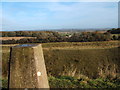
Trig Point at Badbury Rings
View towards King Down Farm
Image: © Peter Barr
Taken: 7 Nov 2008
0.19 miles