
IMAGES TAKEN NEAR TO
Lower Street, WIMBORNE, BH21 5AH
Introduction
This page details the photographs taken nearby to Lower Street, BH21 5AH by members of the Geograph project.
The Geograph project started in 2005 with the aim of publishing, organising and preserving representative images for every square kilometre of Great Britain, Ireland and the Isle of Man.

There are currently over 7.5m images from over14,400 individuals and you can help contribute to the project by visiting https://www.geograph.org.uk
Image Map
Images are licensed for reuse under creativecommons.org/licenses/by-sa/2.0
Notes
- Clicking on the map will re-center to the selected point.
- The higher the marker number, the further away the image location is from the centre of the postcode.
Image Listing (94 Images Found)
Images are licensed for reuse under creativecommons.org/licenses/by-sa/2.0
Image
Details
Distance
1
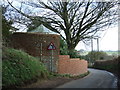
Curved Wall, Lower Street, Witchampton
The footpath to the left leads to the parish church.
The footpath marked on the map crossing the field diagonally to our right, does not appear to exist anymore.
Image: © Lorraine and Keith Bowdler
Taken: 3 Mar 2012
0.01 miles
3
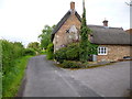
Witchampton, Malthouse Cottage
Thatched cottage at the end of a lane off Lower Street.
Image: © Mike Faherty
Taken: 12 May 2013
0.10 miles
4
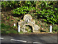
Fountain, Witchampton
A grade II listed 'building'. Spring fed, probably 18th century.
Image: © Robin Webster
Taken: 2 Mar 2017
0.11 miles
5
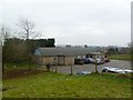
Witchampton Village Hall
Off the village street; out of sight, to the right, there is also a mini-recycling centre. Seen from the churchyard. http://www.charitiesdirect.com/charities/witchampton-village-hall-277822.html
Image: © Mike Faherty
Taken: 12 Feb 2012
0.11 miles
6
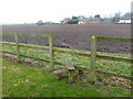
Witchampton, stile
At the beginning of a footpath from Witchampton Lane to Lower Street, across a ploughed field. It doesn't look a well-trodden route!
Image: © Mike Faherty
Taken: 12 Feb 2012
0.11 miles
7

Recycling area, Witchampton
The site is in the car park of the village hall.
Image: © Maigheach-gheal
Taken: 4 May 2009
0.11 miles
8
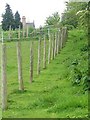
Footpath, Witchampton
The footpath passes pony paddocks as it takes walkers from the village hall to the Methodist Chapel.
Image: © Maigheach-gheal
Taken: 4 May 2009
0.11 miles
10
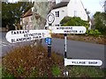
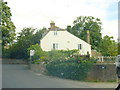
Direction Sign - Signpost by Witchampton Lane, Witchampton
Annulus finial - 4 arms; Dorset halo without NGR by the UC road, in parish of Witchampton (East Dorset District), Lower Street junction with Witchampton Lane, T-junction South of village on small green triangle.
Surveyed
Milestone Society National ID: DO_ST9806
Image: © Milestone Society
Taken: Unknown
0.12 miles