
IMAGES TAKEN NEAR TO
High Lea, WIMBORNE, BH21 5AA
Introduction
This page details the photographs taken nearby to High Lea, BH21 5AA by members of the Geograph project.
The Geograph project started in 2005 with the aim of publishing, organising and preserving representative images for every square kilometre of Great Britain, Ireland and the Isle of Man.

There are currently over 7.5m images from over14,400 individuals and you can help contribute to the project by visiting https://www.geograph.org.uk
Image Map
Images are licensed for reuse under creativecommons.org/licenses/by-sa/2.0
Notes
- Clicking on the map will re-center to the selected point.
- The higher the marker number, the further away the image location is from the centre of the postcode.
Image Listing (9 Images Found)
Images are licensed for reuse under creativecommons.org/licenses/by-sa/2.0
Image
Details
Distance
1
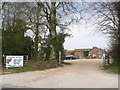
Honeybrook Butchery
This butchers farm shop is situated at High Lea farm at the junction of Witchampton Lane and the B3078. It is open 7am to 4 pm Tuesday to Saturday.
Image: © Nigel Mykura
Taken: 28 Mar 2013
0.02 miles
4
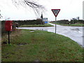
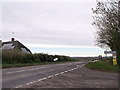
Hinton Martell: postbox № BH21 30, High Lea
This postbox is a little way down the Witchampton road from the B3078, which crosses the picture. The box is emptied at 2:45pm on weekdays and at 10:30am on Saturdays.
Image: © Chris Downer
Taken: 30 Nov 2008
0.07 miles
7
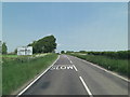
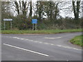
B3078 crossroads south of High Lea Farm
To the left Witchampton Lane and to the right Woodcutt Lane.
Image: © Stuart Logan
Taken: 4 Jun 2013
0.10 miles
9
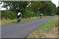
Cyclists on the lane to Hinton Martell
Image: © David Martin
Taken: 13 Aug 2019
0.19 miles