
IMAGES TAKEN NEAR TO
Hillbutts, WIMBORNE, BH21 4DS
Introduction
This page details the photographs taken nearby to BH21 4DS by members of the Geograph project.
The Geograph project started in 2005 with the aim of publishing, organising and preserving representative images for every square kilometre of Great Britain, Ireland and the Isle of Man.

There are currently over 7.5m images from over14,400 individuals and you can help contribute to the project by visiting https://www.geograph.org.uk
Image Map
Images are licensed for reuse under creativecommons.org/licenses/by-sa/2.0
Notes
- Clicking on the map will re-center to the selected point.
- The higher the marker number, the further away the image location is from the centre of the postcode.
Image Listing (19 Images Found)
Images are licensed for reuse under creativecommons.org/licenses/by-sa/2.0
Image
Details
Distance
1

Ordnance Survey Flush Bracket (192) & Cut Mark
This OS Flush Bracket, 192, marks a point 149.4660ft above mean sea level. It can be found on the end of this house at Hillbutts.
Image: © Adrian Dust
Taken: 18 Sep 2013
0.01 miles
2

Thatched cottage
Pamphill near Wimborne, Dorset.
A beautiful Autumn day now the remnants of a hurricane have passed by.
Image: © stewart farrington
Taken: 27 Sep 2012
0.12 miles
3

Old Direction Sign - Signpost by the B3082, Blandford Road, Pamphill
Annulus and bar finial - 4 arms; Dorset halo with NGR by the B3082, in parish of Pamphill (East Dorset District), Pamphill, at crossroads, UC roads to village and Chilbridge Farm on verge.
Surveyed
Milestone Society National ID: DO_ST9901
Image: © Milestone Society
Taken: Unknown
0.12 miles
4

Finger post, Hillbutts
A traditional style sign with the grid reference given on the finial.
Image: © Maigheach-gheal
Taken: 28 Jul 2009
0.13 miles
5

Pamphill: Hillbutts finger-post
A traditional Dorset signpost, retaining the original finial which gives location (Pamphill, Hillbutts) through the middle and the grid reference around the bottom of the circle.
The north-pointing arm is currently broken, laying on the ground below the signpost, but has since been repaired – see Image
For a close-up of the finial, see Image
Image: © Chris Downer
Taken: 8 Aug 2009
0.13 miles
6
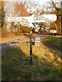
Pamphill: repaired signpost at Hillbutts
Since I took this picture: Image, the missing finger, which at that time was laying on the ground, has been re-affixed. It points north to Hound Hill, adding the comment 'No through road'.
For a close-up of the finial, see Image
Image: © Chris Downer
Taken: 7 Mar 2010
0.13 miles
7

Hillbutts, Pound Farm
As seen from Chilbridge Lane.
Image: © Mike Faherty
Taken: 27 Mar 2010
0.13 miles
8

Pamphill: Hillbutts finger-post detail
A close-up of the finial of the finger-post (see Image), giving location and grid reference details.
Image: © Chris Downer
Taken: 7 Mar 2010
0.13 miles
9

Hill Butts House
Former vicarage at the junction of Blandford Road and Chilbridge Lane; listed by English Heritage http://www.imagesofengland.org.uk/Details/Default.aspx?id=107230&mode=adv
Image: © Mike Faherty
Taken: 27 Mar 2010
0.13 miles
10
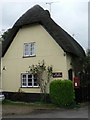
Hillbutts: the old post office and postbox № BH21 69
The post office at Hillbutts closed down around the turn of the 21st century.
Image: © Chris Downer
Taken: 7 Sep 2008
0.14 miles