
IMAGES TAKEN NEAR TO
Sleight Lane, WIMBORNE, BH21 3HL
Introduction
This page details the photographs taken nearby to Sleight Lane, BH21 3HL by members of the Geograph project.
The Geograph project started in 2005 with the aim of publishing, organising and preserving representative images for every square kilometre of Great Britain, Ireland and the Isle of Man.

There are currently over 7.5m images from over14,400 individuals and you can help contribute to the project by visiting https://www.geograph.org.uk
Image Map
Images are licensed for reuse under creativecommons.org/licenses/by-sa/2.0
Notes
- Clicking on the map will re-center to the selected point.
- The higher the marker number, the further away the image location is from the centre of the postcode.
Image Listing (26 Images Found)
Images are licensed for reuse under creativecommons.org/licenses/by-sa/2.0
Image
Details
Distance
1
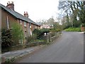
Victoria cottages, Sleight Lane
A short line of attached cottages, where the author has had some interesting parties.
Image: © John Palmer
Taken: 30 Mar 2009
0.03 miles
2
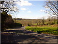
Pardy's Hill
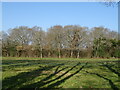
From the bench on Pardy's Hill
Image: © Simon Scurr
Taken: 19 Mar 2007
0.10 miles
3
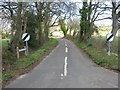
Sleight Lane, Corfe Mullen
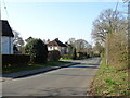
The start of the lane, which gets steeper with older houses further along
Image: © John Palmer
Taken: 30 Mar 2009
0.10 miles
4
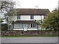
Spring cottage, Brog Street
Overlooking the green at Brog Street stands Spring Cottage, a late 19th century cottage with older origins, having rendered walls under a clay tiled gabled roof. The roof features two chimneystacks, one square in plan, the other rectangular. The front of the cottage has a simple elevation, with small casement windows at first floor level and a long, narrowly projecting bay at ground level. This is fully glazed, divided by well-proportioned mullions, and with a half-glazed front door located in the centre. The cottage faces directly onto the road, behind a short front garden enclosed by a low brick wall.
Image: © John Palmer
Taken: 16 Apr 2009
0.11 miles
7
B3074, Sleight
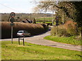
The higher Blandford Road at Sleight.
Image: © Simon Scurr
Taken: 19 Mar 2007
0.17 miles
8
Old wall at Brog Street
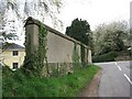
The high cob wall on the west side of the triangle at Brog Street once formed part of a range of thatched barns, and has green sandstone rubble footings. The wall is now capped with tile and ridge tile capping, and forms part of the Brog Street Conservation Area.
Image: © John Palmer
Taken: 16 Apr 2009
0.17 miles
9
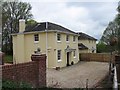
Rose House & Field House
These are a matching pair of detached houses built in 1937. These double-fronted houses, of simple square plan-form, have symmetrical brick elevations under low hipped slate roofs. Their formality is enhanced by tall chimney stacks at each side and by their distinctive central doorways, having sweeping profile lead hoods supported by scroll brackets. The symmetrical pair forms a prominent feature when viewed from the triangular green. They are part of the Brog Street Conservation Area.
Image: © John Palmer
Taken: 16 Apr 2009
0.18 miles
10
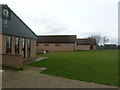
Corfe Mullen, meeting halls
At the end of Badbury View Road, overlooking Corfe Mullen Recreation Ground; from the left, pre-school, guides' HQ, scouts' HQ.
Image: © Mike Faherty
Taken: 19 Jan 2012
0.18 miles