
IMAGES TAKEN NEAR TO
Leigh Lane, WIMBORNE, BH21 2PS
Introduction
This page details the photographs taken nearby to Leigh Lane, BH21 2PS by members of the Geograph project.
The Geograph project started in 2005 with the aim of publishing, organising and preserving representative images for every square kilometre of Great Britain, Ireland and the Isle of Man.

There are currently over 7.5m images from over14,400 individuals and you can help contribute to the project by visiting https://www.geograph.org.uk
Image Map
Images are licensed for reuse under creativecommons.org/licenses/by-sa/2.0
Notes
- Clicking on the map will re-center to the selected point.
- The higher the marker number, the further away the image location is from the centre of the postcode.
Image Listing (11 Images Found)
Images are licensed for reuse under creativecommons.org/licenses/by-sa/2.0
Image
Details
Distance
1
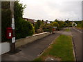
Colehill: postbox № BH21 165, Leigh Lane
A small postbox serving the residents of Leigh Lane and The Vineries; it is emptied finally at 5:20pm on weekdays and at 11:15am on Saturdays.
Image: © Chris Downer
Taken: 10 Jun 2009
0.10 miles
3
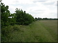
Colehill, hedge
Oak hedge in Bytheway Field.
Image: © Mike Faherty
Taken: 19 Jun 2010
0.17 miles
4
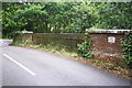
Railway bridge near Wimborne, Dorset
An ornate bridge over the disused Wimborne to Brockenhurst railway at Northleigh Lane, Wimborne.
Image: © Ron Strutt
Taken: 15 Aug 2004
0.18 miles
5
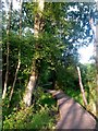
Colehill: boardwalk on Leigh Common
The Common features several paths - some gravelled and some, where necessary, elevated as a boardwalk - and is mainly woodland with a little open meadow.
This boardwalk along the northern side of the common takes a rather splendidly meandering path.
Image: © Chris Downer
Taken: 22 May 2018
0.19 miles
6
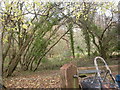
Colehill, woodland
Woodland, with paddocks behind, off Image
Image: © Mike Faherty
Taken: 13 Dec 2009
0.20 miles
7
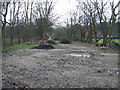
Line of Castleman Railway, Wimborne
This section of the Southampton to Dorchester railway closed in 1964.
Image: © Lorraine and Keith Bowdler
Taken: 27 Mar 2010
0.20 miles
9
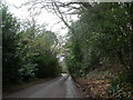
Colehill, Northleigh Lane
Steep, winding lane from Colehill (on a hill) down to Leigh, in the Stour valley; bordered by larger properties, gardens, woodland & paddocks.
Image: © Mike Faherty
Taken: 13 Dec 2009
0.24 miles
10
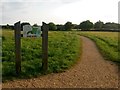
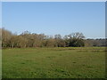
Colehill: across Bytheway Field
Looking westward across this vast, lovely open space from near the Churchmoor Road entrance, on its eastern side.
The information board proclaims it as "a great place for people and wildlife" and on an evening like this it was certainly very popular.
I recall in the early 1980s, as a child, passing the house called Bytheway just along here, and initially thinking it was Welsh!
Image: © Chris Downer
Taken: 22 May 2018
0.25 miles