IMAGES TAKEN NEAR TO
Freemans Lane, WIMBORNE, BH21 2JN
Introduction
This page details the photographs taken nearby to Freemans Lane, BH21 2JN by members of the Geograph project.
The Geograph project started in 2005 with the aim of publishing, organising and preserving representative images for every square kilometre of Great Britain, Ireland and the Isle of Man.

There are currently over 7.5m images from over14,400 individuals and you can help contribute to the project by visiting https://www.geograph.org.uk
Image Map
Images are licensed for reuse under creativecommons.org/licenses/by-sa/2.0
Notes
- Clicking on the map will re-center to the selected point.
- The higher the marker number, the further away the image location is from the centre of the postcode.
Image Listing (13 Images Found)
Images are licensed for reuse under creativecommons.org/licenses/by-sa/2.0
Image
Details
Distance
1
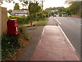
Colehill: postbox № BH21 150, Canford Bottom
This little postbox receives its last daily collections at 5:15pm on weekdays and at noon on Saturdays.
Image: © Chris Downer
Taken: 24 Jun 2009
0.12 miles
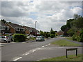
4
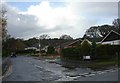
Colehill, bungalows
Modern bungalows on Dales Close, off Dales Drive; Cannon Hill in the background.
Image: © Mike Faherty
Taken: 29 Nov 2009
0.17 miles
5
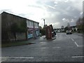
Colehill, convenience store
One-Stop, at the junction of Canford Bottom and Dales Drive.
Image: © Mike Faherty
Taken: 29 Nov 2009
0.18 miles
6
Colehill, Cutlers Place
A crescent-shaped housing development off Middlehill Road.
Image: © Mike Faherty
Taken: 19 Jun 2010
0.21 miles
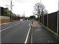
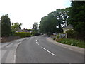
7
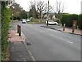
House on Wimborne Rd West
This detached house is on the corner of Stapehill Crescent whose houses tend to have large gardens as well as there being a Green in the centre of the crescent.
Image: © Nigel Mykura
Taken: 6 Mar 2013
0.22 miles
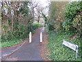
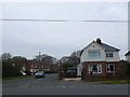
10
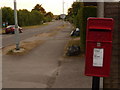
Stapehill: postbox № BH21 142, Wimborne Road West
This George VI-reign postbox stands outside the convenience store on the corner of Stapehill Crescent (the post office, which has recently closed down, was never here but was about ½ mile east). It is emptied finally at 5:30pm on weekdays and at noon on Saturdays.
Image: © Chris Downer
Taken: 24 Jun 2009
0.24 miles