Stapehill: postbox № BH21 142, Wimborne Road West
Introduction
The photograph on this page of Stapehill: postbox № BH21 142, Wimborne Road West by Chris Downer as part of the Geograph project.
The Geograph project started in 2005 with the aim of publishing, organising and preserving representative images for every square kilometre of Great Britain, Ireland and the Isle of Man.

There are currently over 7.5m images from over 14,400 individuals and you can help contribute to the project by visiting https://www.geograph.org.uk
Stapehill: postbox № BH21 142, Wimborne Road West
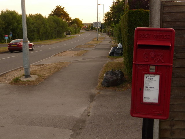
Image: © Chris Downer Taken: 24 Jun 2009
This George VI-reign postbox stands outside the convenience store on the corner of Stapehill Crescent (the post office, which has recently closed down, was never here but was about ½ mile east). It is emptied finally at 5:30pm on weekdays and at noon on Saturdays.
Images are licensed for reuse under creativecommons.org/licenses/by-sa/2.0
Image Location
Latitude
50.801705
Longitude
-1.942051