
IMAGES TAKEN NEAR TO
Wimborne Road West, WIMBORNE, BH21 2DS
Introduction
This page details the photographs taken nearby to Wimborne Road West, BH21 2DS by members of the Geograph project.
The Geograph project started in 2005 with the aim of publishing, organising and preserving representative images for every square kilometre of Great Britain, Ireland and the Isle of Man.

There are currently over 7.5m images from over14,400 individuals and you can help contribute to the project by visiting https://www.geograph.org.uk
Image Map
Images are licensed for reuse under creativecommons.org/licenses/by-sa/2.0
Notes
- Clicking on the map will re-center to the selected point.
- The higher the marker number, the further away the image location is from the centre of the postcode.
Image Listing (17 Images Found)
Images are licensed for reuse under creativecommons.org/licenses/by-sa/2.0
Image
Details
Distance
1
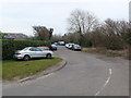
Old Ham Lane
This is the junction of Old ham Lane with Wimborne Rd West.Its verges are very much used as a car park perhaps by people working in nearby businesses. Only the foreground is actually in this grid square as this is in the very south east corner of the grid square.
Image: © Nigel Mykura
Taken: 6 Mar 2013
0.01 miles
2
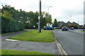
B3073 Wimborne Road West
The car is emerging from Old Ham Lane.
Image: © Robin Webster
Taken: 3 Nov 2018
0.03 miles
3

Stapehill: bird in the bush
A cleverly trimmed hedge in Wimborne Road West.
Image: © Chris Downer
Taken: Unknown
0.03 miles
4
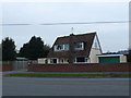
Chalet Bungalow
This kind of architecture is typical of modernist houses built in the 1970's and 1980's with the external chimney stack breaking up the lines of a rather simple basic structure.
Image: © Nigel Mykura
Taken: 6 Mar 2013
0.04 miles
5
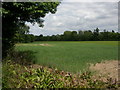
Hayes, cornfield
A wedge of land between Wimborne Road West and Wimborne By-pass.
Image: © Mike Faherty
Taken: 19 Jun 2010
0.05 miles
6
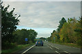
A31 - parking 1/4 mile ahead
Running along the valley of the River Stour.
Image: © Robin Webster
Taken: 30 Oct 2012
0.07 miles
8
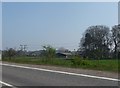
East Dorset : The A31 Roadside
Looking towards the grassy fields and countryside from the A31.
Image: © Lewis Clarke
Taken: 30 Mar 2012
0.10 miles
9
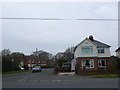
House on Wimborne Rd West
This detached house is on the corner of Stapehill Crescent whose houses tend to have large gardens as well as there being a Green in the centre of the crescent.
Image: © Nigel Mykura
Taken: 6 Mar 2013
0.10 miles
10
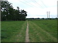
Castleman Trailway, Near Little Canford
Image: © Lorraine and Keith Bowdler
Taken: 29 May 2011
0.13 miles