
IMAGES TAKEN NEAR TO
Parmiter Way, WIMBORNE, BH21 2BS
Introduction
This page details the photographs taken nearby to Parmiter Way, BH21 2BS by members of the Geograph project.
The Geograph project started in 2005 with the aim of publishing, organising and preserving representative images for every square kilometre of Great Britain, Ireland and the Isle of Man.

There are currently over 7.5m images from over14,400 individuals and you can help contribute to the project by visiting https://www.geograph.org.uk
Image Map
Images are licensed for reuse under creativecommons.org/licenses/by-sa/2.0
Notes
- Clicking on the map will re-center to the selected point.
- The higher the marker number, the further away the image location is from the centre of the postcode.
Image Listing (18 Images Found)
Images are licensed for reuse under creativecommons.org/licenses/by-sa/2.0
Image
Details
Distance
2
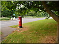
Colehill: postbox № BH21 10, Leigh Road
This postbox stands under the foliage of a tree on a grassy patch between Leigh and Brookside Roads, virtually on the boundary between Colehill parish and Wimborne Minster town. Its final collection occurs at 5:30pm on weekdays and at 11:30am on Saturdays.
Image: © Chris Downer
Taken: 10 Jun 2009
0.09 miles
4
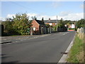
Wimborne, pumping station
Sewage pumping station, at the junction of Brook and Livingstone Roads.
Image: © Mike Faherty
Taken: 25 Oct 2009
0.13 miles
5
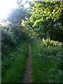
Wimborne Minster: footpath to Parmiter Drive
This public footpath heads from Canford Magna to Leigh Common and this is the last northbound stretch before reaching suburban Wimborne at the dead end of Parmiter Drive.
Image: © Chris Downer
Taken: 22 May 2018
0.13 miles
6
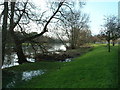
The River Stour at Wimborne Minster
View looking west
Image: © John Smitten
Taken: 17 Nov 2002
0.15 miles
7
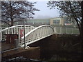
New Footbridge
This is the new footbridge over the river Allen in Wimborne town centre.This links the existing shopping precinct to Waitrose on the other side of the river.
Image: © Jules
Taken: 1 Dec 2016
0.15 miles
8
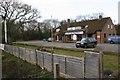
Wimborne Minster
This picture is of an old PH now The Tops Day Nursery, on the B3073 road in the north of the square.
Image: © Brendan and Ruth McCartney
Taken: Unknown
0.15 miles
9
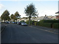
Wimborne, Barnes Crescent
1930s-looking bungalows.
Image: © Mike Faherty
Taken: 25 Oct 2009
0.17 miles
10
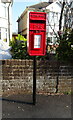
Elizabeth II postbox on Leigh Road
Postbox No. BH21 98.
Image: © JThomas
Taken: 23 Mar 2022
0.17 miles