
IMAGES TAKEN NEAR TO
Layard Drive, WIMBORNE, BH21 1TF
Introduction
This page details the photographs taken nearby to Layard Drive, BH21 1TF by members of the Geograph project.
The Geograph project started in 2005 with the aim of publishing, organising and preserving representative images for every square kilometre of Great Britain, Ireland and the Isle of Man.

There are currently over 7.5m images from over14,400 individuals and you can help contribute to the project by visiting https://www.geograph.org.uk
Image Map
Images are licensed for reuse under creativecommons.org/licenses/by-sa/2.0
Notes
- Clicking on the map will re-center to the selected point.
- The higher the marker number, the further away the image location is from the centre of the postcode.
Image Listing (5 Images Found)
Images are licensed for reuse under creativecommons.org/licenses/by-sa/2.0
Image
Details
Distance
1
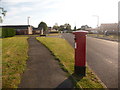
Merley: postbox № BH21 189, Merley Gardens
This George V-reign postbox serves part of this fairly modern estate, and is emptied finally at 5:30pm on weekdays and at 11:30am on Saturdays.
Image: © Chris Downer
Taken: 10 Jun 2009
0.06 miles
2
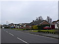
Houses in Rempstone Rd
These houses are on the waest side of the road close to its junction with Merley Gardens. They are mostly bungalows with one or two larger detached houses.
Image: © Nigel Mykura
Taken: 6 Mar 2013
0.14 miles
3
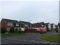
Rempstone Rd
Rempstone Rd is one of those long residential roads with numerous side cul de sacs that are all under the same road name. This particular cul de sac contains the houses with even numbers from 96 to 134.
Image: © Nigel Mykura
Taken: 6 Mar 2013
0.14 miles
4
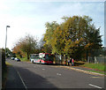
The Wimborne Flyer
The Wimborne Flyer bus route links Poole with Wimborne; buses running alternatively via Corfe Mullen or, as illustrated here, Merley. Wilts & Dorset bus no.162 draws to a halt at the stop outside Merley First School.
Image: © Peter Kazmierczak
Taken: 26 Oct 2009
0.24 miles
5
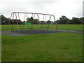
Merley, recreation ground
Fenners Recreation Ground, off Merley Lane. http://www.boroughofpoole.com/facilities/ref:F465e9bc757a34/
Image: © Mike Faherty
Taken: 22 Oct 2009
0.24 miles