IMAGES TAKEN NEAR TO
Gravel Hill, WIMBORNE, BH21 1RW
Introduction
This page details the photographs taken nearby to Gravel Hill, BH21 1RW by members of the Geograph project.
The Geograph project started in 2005 with the aim of publishing, organising and preserving representative images for every square kilometre of Great Britain, Ireland and the Isle of Man.

There are currently over 7.5m images from over14,400 individuals and you can help contribute to the project by visiting https://www.geograph.org.uk
Image Map
Images are licensed for reuse under creativecommons.org/licenses/by-sa/2.0
Notes
- Clicking on the map will re-center to the selected point.
- The higher the marker number, the further away the image location is from the centre of the postcode.
Image Listing (23 Images Found)
Images are licensed for reuse under creativecommons.org/licenses/by-sa/2.0
Image
Details
Distance
1
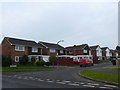
Rempstone Rd
Rempstone Rd is one of those long residential roads with numerous side cul de sacs that are all under the same road name. This particular cul de sac contains the houses with even numbers from 96 to 134.
Image: © Nigel Mykura
Taken: 6 Mar 2013
0.09 miles
2
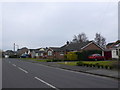
Houses in Rempstone Rd
These houses are on the waest side of the road close to its junction with Merley Gardens. They are mostly bungalows with one or two larger detached houses.
Image: © Nigel Mykura
Taken: 6 Mar 2013
0.13 miles
3
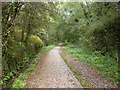
Merley, trailway
Castleman Trailway, on a section of the former Southampton to Dorchester Railway. http://www.dorsetforyou.com/castlemantrailway
Image: © Mike Faherty
Taken: 22 Oct 2009
0.15 miles
4
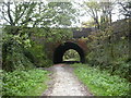
Merley Bridge
Bridge taking A349 (Gravel Hill/Oakley Hill) over the former Southampton to Dorchester Railway line.
Image: © Mike Faherty
Taken: 22 Oct 2009
0.16 miles
5
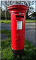
George V postbox on Oakley Hill
Postbox No. BH21 85.
Image: © JThomas
Taken: 24 Mar 2022
0.17 miles
6
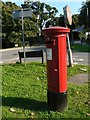
Merley: postbox № BH21 85, Oakley Hill
This postbox stands outside the old Merley post office, which moved east about 30 years ago to serve the large new housing estate.
Image: © Chris Downer
Taken: 21 Sep 2008
0.17 miles
7
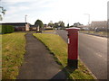
Merley: postbox № BH21 189, Merley Gardens
This George V-reign postbox serves part of this fairly modern estate, and is emptied finally at 5:30pm on weekdays and at 11:30am on Saturdays.
Image: © Chris Downer
Taken: 10 Jun 2009
0.18 miles
8
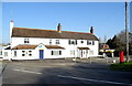
Solicitors on Oakley Hill
Showing position of Postbox No. BH21 85.
Image: © JThomas
Taken: 24 Mar 2022
0.18 miles
9
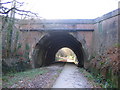
Castleman Trail, north of Broadstone
Merley Bridge, almost a short tunnel, took the Southampton & Dorchester Railway, opened in 1847, diagonally beneath a crossroads on the main Poole to Wimborne road. Passenger services here were withdrawn in 1964, though freight services to Wimborne hung on until 1977, after which the line was quickly dismantled. Later the section between Broadstone and Oakley, south of Wimborne, was converted to a cycleway known as the Castleman Trail, taking its name from the Wimborne solicitor who promoted the railway. Drainage has long been a problem here and it is believed the trackbed was raised in Southern Railway days to lay larger drains, necessitating the cutouts both sides of the arch to ensure that coaching stock and other high-roofed vehicles did not strike the brickwork on the curve through the bridge. The concrete pathway through the bridge is a more recent attempt to prevent waterlogging of the trail.
Image: © A-M-Jervis
Taken: 10 Dec 2007
0.18 miles