
IMAGES TAKEN NEAR TO
Allenview Road, WIMBORNE, BH21 1GT
Introduction
This page details the photographs taken nearby to Allenview Road, BH21 1GT by members of the Geograph project.
The Geograph project started in 2005 with the aim of publishing, organising and preserving representative images for every square kilometre of Great Britain, Ireland and the Isle of Man.

There are currently over 7.5m images from over14,400 individuals and you can help contribute to the project by visiting https://www.geograph.org.uk
Image Map
Images are licensed for reuse under creativecommons.org/licenses/by-sa/2.0
Notes
- Clicking on the map will re-center to the selected point.
- The higher the marker number, the further away the image location is from the centre of the postcode.
Image Listing (325 Images Found)
Images are licensed for reuse under creativecommons.org/licenses/by-sa/2.0
Image
Details
Distance
1
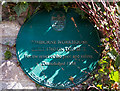
No. 7 (of 12) the Green Plaques of Wimborne - Wimborne Parish Workhouse
Location: Allen Court, East Borough, outside a sheltered housing complex.
Image
Image: © Mike Searle
Taken: 22 Mar 2015
0.04 miles
2
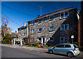
Wimborne - Allen Court, site of Parish Workhouse
Allen Court, sheltered housing for the elderly, built on the site of the former Parish Workhouse.
Image
Image: © Mike Searle
Taken: 22 Mar 2015
0.05 miles
3
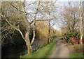
Wimborne, riverside walk
Footpath along the River Allen, from Hanham Road to Walford Mill.
Image: © Mike Faherty
Taken: 13 Dec 2009
0.05 miles
4
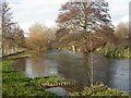
Wimborne, River Allen
Slightly swollen Allen, after recent rain. The Allen is a chalk stream tributary of the Stour, into which it flows just over 1km to the South. The river flows for about 20km, with its source near Wimborne St. Giles Image, to the North. As seen looking upstream.
Image: © Mike Faherty
Taken: 13 Dec 2009
0.05 miles
5
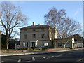
Wimborne, Allendale House
On Hanham Road; according to the plaque, built in 1823 by Sir Jeffry Wyatville for the Castleman family; now the headquarters of East Dorset Heritage Trust. http://www.edht.org.uk/index2.htm
Image: © Mike Faherty
Taken: 13 Dec 2009
0.05 miles
6
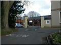
Wimborne, community centre
Allendale Community Centre, off Hanham Road, built in what was probably once the grounds of neighbouring Allendale House. http://www.idorset.co.uk/profile/106503/Wimborne/Allendale-Community-Centre/
Image: © Mike Faherty
Taken: 13 Dec 2009
0.06 miles
7

Wimborne old fire station
Wimborne old fire station, Hanham Road, Wimborne, Dorset is now used as a Citizen's Advice Bureau. It was replaced as a fire station by Image
Image: © Kevin Hale
Taken: 16 Oct 2007
0.07 miles
8

No. 6 (of 12) the Green Plaques of Wimborne - Allendale House
Location: the portico of Allendale House, on the north side of the B3073 (Hanham Road) opposite its junction with East Borough.
Image
Image: © Mike Searle
Taken: 22 Mar 2015
0.07 miles

10

Wimborne - Allendale House
The architect Sir Jeffry Wyatville RA (1766 - 1840) built this house in 1823 for the Castleman family. It is now a local Community Centre. Grade II listed.
http://www.imagesofengland.org.uk/Details/Default.aspx?id=107050&mode=adv
Image
Image: © Mike Searle
Taken: 22 Mar 2015
0.07 miles