
IMAGES TAKEN NEAR TO
Crescent Road, WIMBORNE, BH21 1GH
Introduction
This page details the photographs taken nearby to Crescent Road, BH21 1GH by members of the Geograph project.
The Geograph project started in 2005 with the aim of publishing, organising and preserving representative images for every square kilometre of Great Britain, Ireland and the Isle of Man.

There are currently over 7.5m images from over14,400 individuals and you can help contribute to the project by visiting https://www.geograph.org.uk
Image Map
Images are licensed for reuse under creativecommons.org/licenses/by-sa/2.0
Notes
- Clicking on the map will re-center to the selected point.
- The higher the marker number, the further away the image location is from the centre of the postcode.
Image Listing (80 Images Found)
Images are licensed for reuse under creativecommons.org/licenses/by-sa/2.0
Image
Details
Distance
4
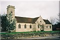
Wimborne Minster: Catholic church of St. Catherine
Image: © Chris Downer
Taken: Unknown
0.05 miles
5
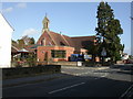
Wimborne, St. John's Church
Parish church on Leigh Road. http://www.stjohnsinfo.org.uk/
Image: © Mike Faherty
Taken: 25 Oct 2009
0.08 miles
6
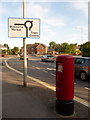
Wimborne Minster: postbox № BH21 216, Lewens Lane
This modern postbox stands close to the junction of Leigh Road (left, to Ferndown) and Poole Road (ahead, to Poole as its name suggests). The last collection times are 5:45pm on weekdays and at 12:15pm on Saturdays.
Image: © Chris Downer
Taken: 10 Jun 2009
0.08 miles
7
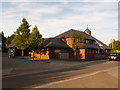
Wimborne Minster: Quarter Jack Surgery
A newish facility in Wimborne – built perhaps fifteen years ago – is named after the Image and has a model of the Jack atop its weather vane.
Image: © Chris Downer
Taken: 10 Jun 2009
0.10 miles
8
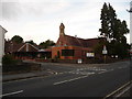
Wimborne Minster: parish church of St. John
This Victorian, brick-built church stands on the corner of Leigh Road and St. John's Hill and has seen some quite modern extensions built on this side, fronting onto Legg Lane.
For another view, see Image
Image: © Chris Downer
Taken: 10 Jun 2009
0.10 miles
9
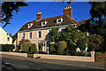
Lewens - Lewens Lane, Wimborne
This is a Grade II Listed house whose origins are in the mid-C17. Altered in the C18, and again subsequently.
Image: © Mike Searle
Taken: 15 Nov 2007
0.11 miles
10
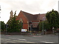
Wimborne Minster: St. John?s from the southeast
An alternative view of the Image, from across the crossroads. Ignoring the traffic lights, this view of the church will never have changed all that much, unlike the view linked above with the modern extensions readily visible.
Image: © Chris Downer
Taken: 10 Jun 2009
0.11 miles